Approximate Location Map
Large Map »
Latitude: 55.4149 / 55°24'53"N
Longitude: -1.7087 / 1°42'31"W
OS Eastings: 418542
OS Northings: 613476
OS Grid: NU185134
Mapcode National: GBR J5HT.WR
Mapcode Global: WHC1K.Q5K7
Plus Code: 9C7WC77R+WG
Entry Name: The Kiln
Listing Date: 25 August 1977
Grade: II
Source: Historic England
Source ID: 1178449
English Heritage Legacy ID: 235806
ID on this website: 101178449
Location: Alnwick, Northumberland, NE66
County: Northumberland
Civil Parish: Alnwick
Built-Up Area: Alnwick
Traditional County: Northumberland
Lieutenancy Area (Ceremonial County): Northumberland
Church of England Parish: Alnwick
Church of England Diocese: Newcastle
Tagged with: Kiln
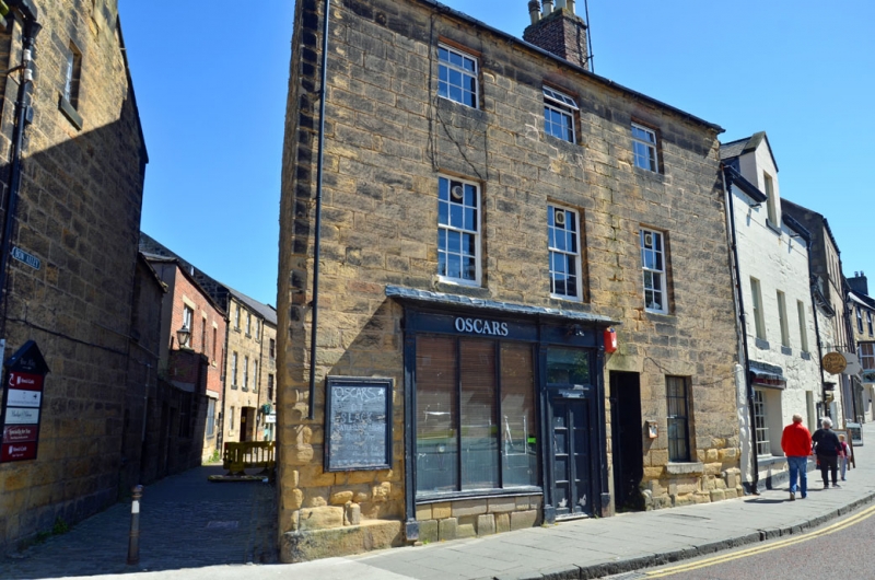
1. NARROWGATE
5330
(North-East Side)
No 34
("The Kiln")
NU 1813 SE 1/327
II GV
2.
Early C19. Three storeys, 3 windows. Plain ashlar front; skew built at side to
Bow Alley. Slate roof. Glazing bar sash windows, single hung on 2nd floor. C20
shop window with door off centre to left; panelled side door off centre to right.
Rear annexe a narrow 3 storey 4 window extension; the 2 upper storeys being of
brick.
Listing NGR: NU1854813477
External links are from the relevant listing authority and, where applicable, Wikidata. Wikidata IDs may be related buildings as well as this specific building. If you want to add or update a link, you will need to do so by editing the Wikidata entry.


Other nearby listed buildings
