Approximate Location Map
Large Map »
Latitude: 54.4088 / 54°24'31"N
Longitude: -0.9504 / 0°57'1"W
OS Eastings: 468224
OS Northings: 501994
OS Grid: NZ682019
Mapcode National: GBR PKTG.1B
Mapcode Global: WHF91.CFPZ
Plus Code: 9C6XC25X+GR
Entry Name: White Cross (South)
Listing Date: 20 December 1990
Grade: II
Source: Historic England
Source ID: 1178658
English Heritage Legacy ID: 327965
ID on this website: 101178658
Location: North Yorkshire, YO21
County: North Yorkshire
District: Scarborough
Civil Parish: Danby
Traditional County: Yorkshire
Lieutenancy Area (Ceremonial County): North Yorkshire
Tagged with: Wayside cross
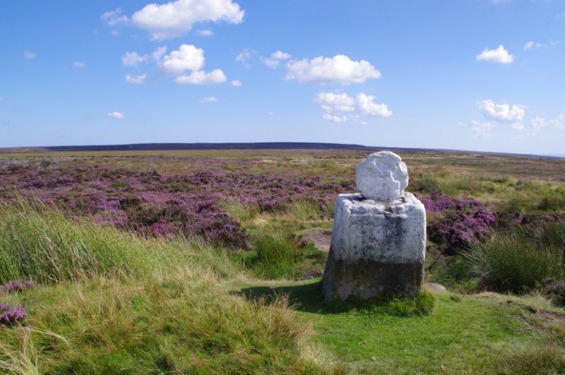
NZ 60 SE 682 020 DANBY DANBY HIGH MOOR
10/47 White Cross
(south)
II
Remains of wayside cross, probably medieval. Hard sandstone.
Large square plinth, about 1m. high and 0.6m. square, with roll-
moulded angles. Crosses incised in east and west faces. Wheel
head of a cross set into socket. Possibly the head and base of a
tall cross, the shaft having disappeared. 0.S.B.M. on south face.
Carved C20 graffiti.
This cross was locally known as Fat Betty.
Listing NGR: NZ6822401994
External links are from the relevant listing authority and, where applicable, Wikidata. Wikidata IDs may be related buildings as well as this specific building. If you want to add or update a link, you will need to do so by editing the Wikidata entry.


Other nearby listed buildings
