Approximate Location Map
Large Map »
Latitude: 54.5061 / 54°30'21"N
Longitude: -0.6972 / 0°41'49"W
OS Eastings: 484459
OS Northings: 513089
OS Grid: NZ844130
Mapcode National: GBR RJKB.VG
Mapcode Global: WHG9Q.8Z8Y
Plus Code: 9C6XG843+C4
Entry Name: Phipps' Farmhouse
Listing Date: 10 December 1985
Grade: II
Source: Historic England
Source ID: 1179937
English Heritage Legacy ID: 327274
ID on this website: 101179937
Location: Lythe, North Yorkshire, YO21
County: North Yorkshire
District: Scarborough
Civil Parish: Lythe
Traditional County: Yorkshire
Lieutenancy Area (Ceremonial County): North Yorkshire
Church of England Parish: Lythe with Sandsend
Church of England Diocese: York
Tagged with: Farmhouse
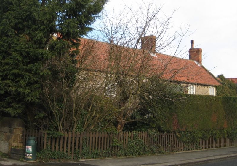
NZ 8413 LYTHE HIGH STREET
(north side) Lythe
13/199
- Phipps' Farmhouse
- II
Farmhouse and cottage, now as one. Early C19. Coursed squared stone. Pantiled
roof with stone copings and curved kneelers, rebuilt brick ridge and end
chimneys. Two storeys, 2 and 2 windows, C19 1-bar casements. Top glazed six-
panel door to right of centre. One storey 1-bay similar right extension.
Listing NGR: NZ8445913089
External links are from the relevant listing authority and, where applicable, Wikidata. Wikidata IDs may be related buildings as well as this specific building. If you want to add or update a link, you will need to do so by editing the Wikidata entry.


Other nearby listed buildings
