Approximate Location Map
Large Map »
Latitude: 51.4161 / 51°24'58"N
Longitude: -0.0779 / 0°4'40"W
OS Eastings: 533758
OS Northings: 170319
OS Grid: TQ337703
Mapcode National: GBR HN.H1Y
Mapcode Global: VHGRD.LNPR
Plus Code: 9C3XCW8C+CR
Entry Name: Pillar Box Outside No 36
Listing Date: 28 April 1986
Grade: II
Source: Historic England
Source ID: 1186821
English Heritage Legacy ID: 358634
ID on this website: 101186821
Location: Norwood New Town, Bromley, London, SE19
County: London
District: Bromley
Electoral Ward/Division: Crystal Palace
Parish: Non Civil Parish
Built-Up Area: Bromley
Traditional County: Surrey
Lieutenancy Area (Ceremonial County): Greater London
Church of England Parish: Anerley Christ Church and St Paul
Church of England Diocese: Rochester
Tagged with: Pillar box
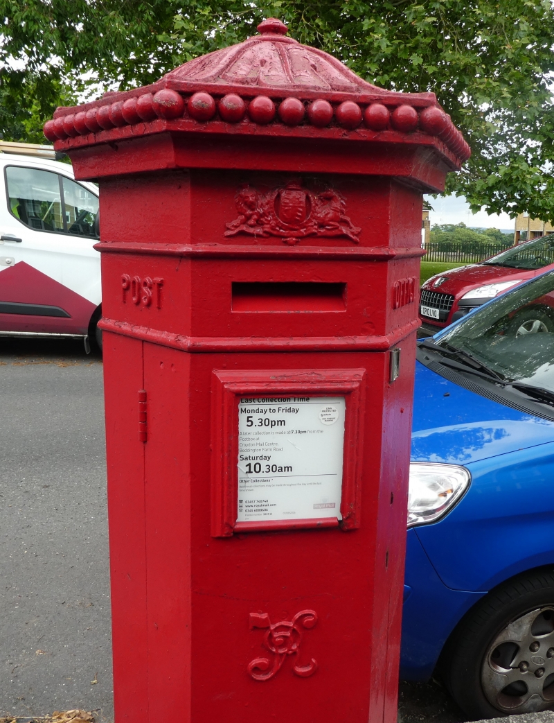
BELVEDERE ROAD, ANERLEY
1.
4407
TQ37SW.SP/730 (South Side)
Pillar Box
II Outside No.36
2.
Pillar-box. Circa 1859-1879. Cast iron hexagonal Penfold design, with foliated
ogee top and knob finial.
Listing NGR: TQ3375870319
External links are from the relevant listing authority and, where applicable, Wikidata. Wikidata IDs may be related buildings as well as this specific building. If you want to add or update a link, you will need to do so by editing the Wikidata entry.


Other nearby listed buildings
