Approximate Location Map
Large Map »
Latitude: 54.2322 / 54°13'55"N
Longitude: -1.3421 / 1°20'31"W
OS Eastings: 442981
OS Northings: 482030
OS Grid: SE429820
Mapcode National: GBR MM2H.7M
Mapcode Global: WHD8H.CW4D
Plus Code: 9C6W6MJ5+V5
Entry Name: Wrights Shop
Listing Date: 15 June 1984
Grade: II
Source: Historic England
Source ID: 1190702
English Heritage Legacy ID: 333310
ID on this website: 101190702
Location: Thirsk, North Yorkshire, YO7
County: North Yorkshire
District: Hambleton
Civil Parish: Thirsk
Built-Up Area: Thirsk
Traditional County: Yorkshire
Lieutenancy Area (Ceremonial County): North Yorkshire
Tagged with: Architectural structure
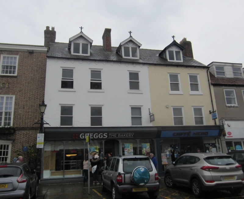
SE 4282 THIRSK MARKET PLACE
6/69 (south side)
GV No 40 (Wright's Shop)
II
House with shop front. C19. Brick, partly rendered. Eaves cornice. Slate roof with
dormers. 3 storeys. 2 bays. Good shop front with segmental arched windows supported
by slender columns. Projecting fascia with bracket to left. Sash windows, above are
vertically linked by rendering.
Listing NGR: SE4298182030
External links are from the relevant listing authority and, where applicable, Wikidata. Wikidata IDs may be related buildings as well as this specific building. If you want to add or update a link, you will need to do so by editing the Wikidata entry.


Other nearby listed buildings
