Approximate Location Map
Large Map »
Latitude: 50.9905 / 50°59'25"N
Longitude: -0.2731 / 0°16'23"W
OS Eastings: 521298
OS Northings: 122649
OS Grid: TQ212226
Mapcode National: GBR HKH.XF6
Mapcode Global: FRA B69H.KFJ
Plus Code: 9C2XXPRG+5Q
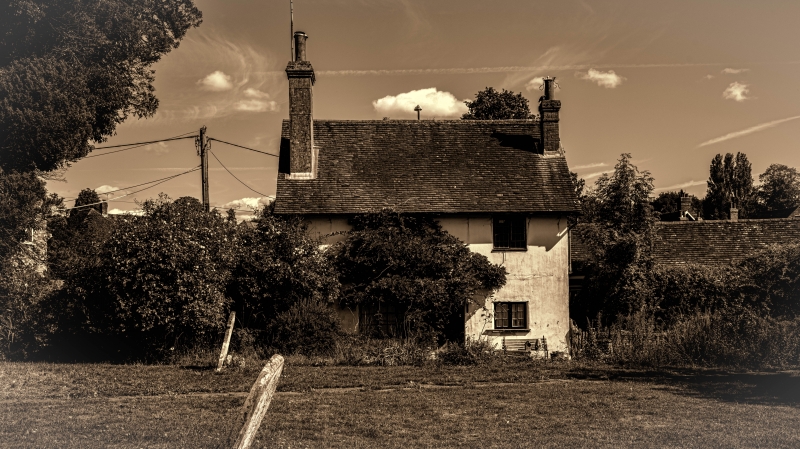
Entry Name: Sussex House
Listing Date: 28 November 1980
Grade: II
Source: Historic England
Source ID: 1193219
English Heritage Legacy ID: 299202
ID on this website: 101193219
Location: Cowfold, Horsham, West Sussex, RH13
County: West Sussex
District: Horsham
Civil Parish: Cowfold
Built-Up Area: Cowfold
Traditional County: Sussex
Lieutenancy Area (Ceremonial County): West Sussex
Church of England Parish: Cowfold St Peter
Church of England Diocese: Chichester
Tagged with: House
COWFOLD STATION ROAD
1.
5404 Sussex House
TQ 2122 26/563
II GV
2.
C18. Two storeys. Two windows. Plastered front. Tiled roof. Casement
windows. Doorway with pediment-shaped hood. Included for group value.
Listing NGR: TQ2129822649
External links are from the relevant listing authority and, where applicable, Wikidata. Wikidata IDs may be related buildings as well as this specific building. If you want to add or update a link, you will need to do so by editing the Wikidata entry.


Other nearby listed buildings
