Approximate Location Map
Large Map »
Latitude: 50.9554 / 50°57'19"N
Longitude: -0.4865 / 0°29'11"W
OS Eastings: 506398
OS Northings: 118420
OS Grid: TQ063184
Mapcode National: GBR GJG.3S8
Mapcode Global: FRA 96WL.68V
Plus Code: 9C2XXG47+59
Entry Name: Hillside
Listing Date: 9 May 1980
Grade: II
Source: Historic England
Source ID: 1194060
English Heritage Legacy ID: 298631
ID on this website: 101194060
Location: Marehill, Horsham, West Sussex, RH20
County: West Sussex
District: Horsham
Civil Parish: Pulborough
Built-Up Area: West Chiltington Common
Traditional County: Sussex
Lieutenancy Area (Ceremonial County): West Sussex
Church of England Parish: Pulborough St Mary
Church of England Diocese: Chichester
Tagged with: Building
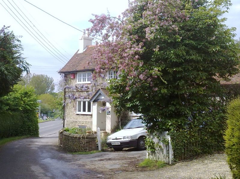
PULBOROUGH WEST MARE LANE
1.
5404
Mare Hill
Hillside
TQ 01 NE 6/757
II
2.
Early C19. Two storeys. Three windows. Stuccoed. Stringcourse. Tiled roof. Casement
windows. Gabled porch.
Listing NGR: TQ0639818420
External links are from the relevant listing authority and, where applicable, Wikidata. Wikidata IDs may be related buildings as well as this specific building. If you want to add or update a link, you will need to do so by editing the Wikidata entry.


Other nearby listed buildings
