Approximate Location Map
Large Map »
Latitude: 51.5073 / 51°30'26"N
Longitude: -2.6312 / 2°37'52"W
OS Eastings: 356285
OS Northings: 178893
OS Grid: ST562788
Mapcode National: GBR JP.J6TN
Mapcode Global: VH88F.BCTW
Plus Code: 9C3VG949+WG
Entry Name: Gas Lamp Post on West Corner with Henbury Road
Listing Date: 30 December 1994
Grade: II
Source: Historic England
Source ID: 1205187
English Heritage Legacy ID: 379156
ID on this website: 101205187
Location: Henbury, Bristol, BS10
County: City of Bristol
Electoral Ward/Division: Henbury and Brentry
Parish: Non Civil Parish
Built-Up Area: Bristol
Traditional County: Gloucestershire
Lieutenancy Area (Ceremonial County): Bristol
Church of England Parish: Henbury
Church of England Diocese: Bristol
Tagged with: Gas streetlight
BRISTOL
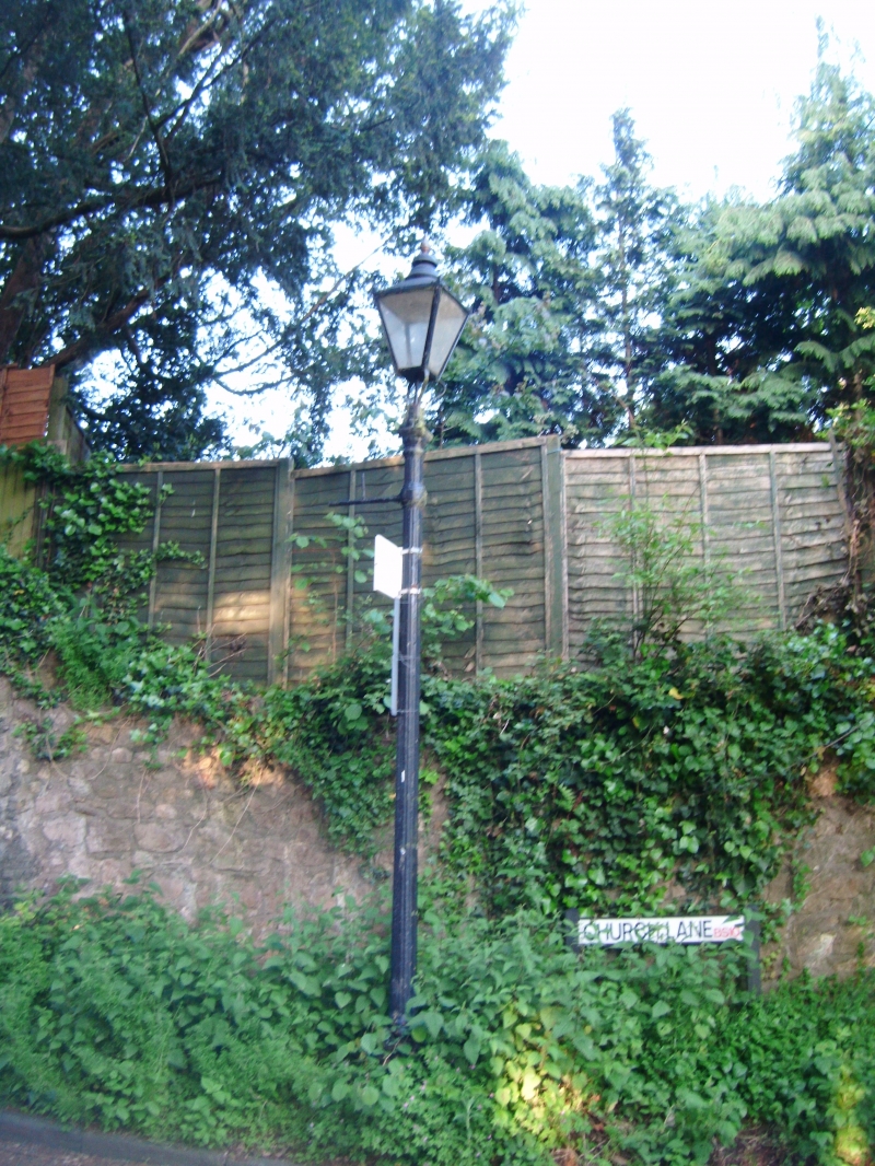
ST5678NW CHURCH LANE, Henbury
901-1/17/1333 (West side)
Gas lamp post on west corner with
Henbury Road
GV II
Gas lamp post. Mid C19. Cast-iron. A fluted shaft with a
switch bar and square lantern. Converted to electricity.
Listing NGR: ST5628478895
External links are from the relevant listing authority and, where applicable, Wikidata. Wikidata IDs may be related buildings as well as this specific building. If you want to add or update a link, you will need to do so by editing the Wikidata entry.


Other nearby listed buildings
