Approximate Location Map
Large Map »
Latitude: 52.6169 / 52°37'0"N
Longitude: -2.4422 / 2°26'31"W
OS Eastings: 370158
OS Northings: 302216
OS Grid: SJ701022
Mapcode National: GBR BY.87GD
Mapcode Global: WH9DH.GH85
Plus Code: 9C4VJH85+Q4
Entry Name: Coalport House
Listing Date: 22 January 1975
Grade: II
Source: Historic England
Source ID: 1206656
English Heritage Legacy ID: 362011
ID on this website: 101206656
Location: Coalport, Telford and Wrekin, Shropshire, TF8
County: Telford and Wrekin
Civil Parish: The Gorge
Traditional County: Shropshire
Lieutenancy Area (Ceremonial County): Shropshire
Church of England Parish: Madeley
Church of England Diocese: Hereford
Tagged with: House
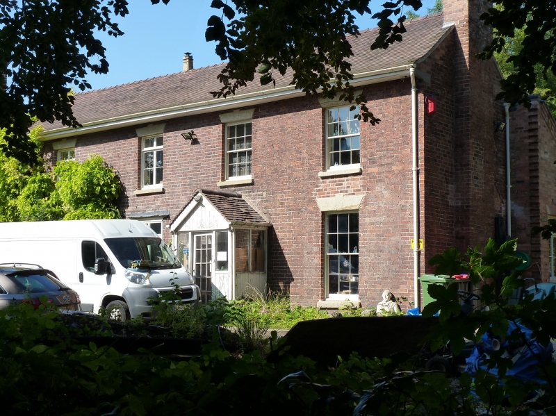
COALPORT COALPORT HIGH STREET
1.
5362 Coalport House
SJ 70 SW 34/147 22.1.75
II
2.
Early/mid C19 red brick range. New tile roof. Two storeys; 4 windows. Sashes and
later casements, all with plain stone keyblocks and lintels. Half-glazed door with
glazed modern porch. Modern additions at rear.
Listing NGR: SJ7015802216
External links are from the relevant listing authority and, where applicable, Wikidata. Wikidata IDs may be related buildings as well as this specific building. If you want to add or update a link, you will need to do so by editing the Wikidata entry.


Other nearby listed buildings
