Approximate Location Map
Large Map »
Latitude: 52.6268 / 52°37'36"N
Longitude: -2.4841 / 2°29'2"W
OS Eastings: 367325
OS Northings: 303331
OS Grid: SJ673033
Mapcode National: GBR BW.7P4G
Mapcode Global: WH9DG.T78L
Plus Code: 9C4VJGG8+P8
Entry Name: 5 and 6, Ladywood
Listing Date: 9 August 1974
Grade: II
Source: Historic England
Source ID: 1207676
English Heritage Legacy ID: 362178
ID on this website: 101207676
Location: Ironbridge, Telford and Wrekin, Shropshire, TF8
County: Telford and Wrekin
Civil Parish: The Gorge
Built-Up Area: Telford
Traditional County: Shropshire
Lieutenancy Area (Ceremonial County): Shropshire
Church of England Parish: Broseley with Benthall and Jackfield
Church of England Diocese: Hereford
Tagged with: Building
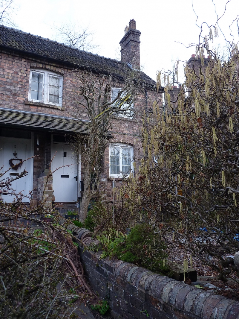
IRONBRIDGE LADYWOOD
1.
5362
Nos 5 and 6
SJ 6703 SW 15/321 9.8.74
II GV
2.
A pair of plain early C19 cottages. Red brick; 2 storeys; 3 wood casement windows
with cambered heads; 2 plain doorways with plain rectangular fanlights and flush
4-panelled doors; plain eaves; tiled roof. Included for group value.
Listing NGR: SJ6732503331
External links are from the relevant listing authority and, where applicable, Wikidata. Wikidata IDs may be related buildings as well as this specific building. If you want to add or update a link, you will need to do so by editing the Wikidata entry.


Other nearby listed buildings
