Approximate Location Map
Large Map »
Latitude: 54.4018 / 54°24'6"N
Longitude: -1.7391 / 1°44'20"W
OS Eastings: 417032
OS Northings: 500737
OS Grid: NZ170007
Mapcode National: GBR JK9J.8V
Mapcode Global: WHC6D.8M3C
Plus Code: 9C6WC726+P8
Entry Name: The Bar
Listing Date: 1 August 1952
Grade: II*
Source: Historic England
Source ID: 1211647
English Heritage Legacy ID: 322865
ID on this website: 101211647
Location: Richmond, North Yorkshire, DL10
County: North Yorkshire
District: Richmondshire
Civil Parish: Richmond
Built-Up Area: Richmond
Traditional County: Yorkshire
Lieutenancy Area (Ceremonial County): North Yorkshire
Church of England Parish: Richmond with Holy Trinity with Hudswell
Church of England Diocese: Leeds
Tagged with: Architectural structure
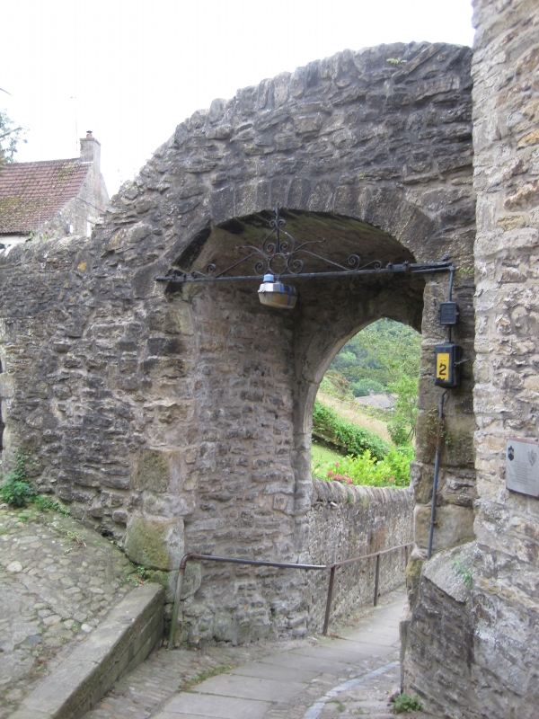
1. THE BAR
1549 (West Side)
The Bar
NZ 1700 NW 1/12 1.8.52.
II* GV
2.
Circa 1312. Chamfered semi-circular archway in stone; buttresses on the
West side. Part of the original Town Wall.
Nos 1 to 8 (consec) and the Bar from a group
Listing NGR: NZ1703200737
External links are from the relevant listing authority and, where applicable, Wikidata. Wikidata IDs may be related buildings as well as this specific building. If you want to add or update a link, you will need to do so by editing the Wikidata entry.


Other nearby listed buildings
