Approximate Location Map
Large Map »
Latitude: 54.4056 / 54°24'20"N
Longitude: -1.7341 / 1°44'2"W
OS Eastings: 417360
OS Northings: 501157
OS Grid: NZ173011
Mapcode National: GBR JKBH.CH
Mapcode Global: WHC6D.BJHG
Plus Code: 9C6WC748+69
Entry Name: 71, Frenchgate
Listing Date: 15 October 1973
Grade: II
Source: Historic England
Source ID: 1211963
English Heritage Legacy ID: 322971
ID on this website: 101211963
Location: Richmond, North Yorkshire, DL10
County: North Yorkshire
District: Richmondshire
Civil Parish: Richmond
Built-Up Area: Richmond
Traditional County: Yorkshire
Lieutenancy Area (Ceremonial County): North Yorkshire
Church of England Parish: Richmond with Holy Trinity with Hudswell
Church of England Diocese: Leeds
Tagged with: Building
1.
1549
NZ 1701 SW
3/82
FRENCHGATE
(West Side)
No 71
II
GV
2.
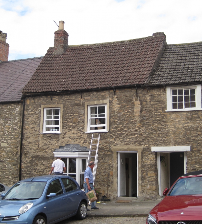
Mid C18. Two storeys in rubble. Modern asbestos pantiles. Two windows,
rendered surround. C19 canted bay on ground floor. Modern door. Included
group value.
Nos 55 to 75 (odd) and Nos 79 to 83 (odd) form a group
Listing NGR: NZ1736001157
External links are from the relevant listing authority and, where applicable, Wikidata. Wikidata IDs may be related buildings as well as this specific building. If you want to add or update a link, you will need to do so by editing the Wikidata entry.


Other nearby listed buildings
