Approximate Location Map
Large Map »
Latitude: 53.6492 / 53°38'57"N
Longitude: -1.7545 / 1°45'16"W
OS Eastings: 416327
OS Northings: 416993
OS Grid: SE163169
Mapcode National: GBR JV57.YL
Mapcode Global: WHCB2.0JTT
Plus Code: 9C5WJ6XW+M6
Entry Name: 111 and 113, Long Lane
Listing Date: 29 September 1978
Grade: II
Source: Historic England
Source ID: 1215163
English Heritage Legacy ID: 340147
ID on this website: 101215163
Location: Grove Place, Kirklees, West Yorkshire, HD5
County: Kirklees
Electoral Ward/Division: Dalton
Parish: Non Civil Parish
Built-Up Area: Huddersfield
Traditional County: Yorkshire
Lieutenancy Area (Ceremonial County): West Yorkshire
Church of England Parish: Kirkheaton St John the Baptist
Church of England Diocese: Leeds
Tagged with: Building
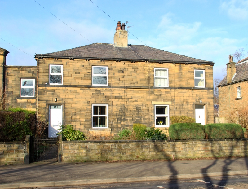
LONG LANE
1.
5113
(North Side)
Nos 111 and 113
SE 1617 29/826
SE 1616 35/826
II GV
2.
Mid C19. Ashlar. Hipped slate roof. 2 storeys. Band. 4 ranges of sashes.
2 doors with fanlights, No 111's with 4 fielded panels. One range of sashes
set back flush to church.
Listing NGR: SE1632716993
External links are from the relevant listing authority and, where applicable, Wikidata. Wikidata IDs may be related buildings as well as this specific building. If you want to add or update a link, you will need to do so by editing the Wikidata entry.


Other nearby listed buildings
