Approximate Location Map
Large Map »
Latitude: 52.924 / 52°55'26"N
Longitude: -1.4863 / 1°29'10"W
OS Eastings: 434630
OS Northings: 336413
OS Grid: SK346364
Mapcode National: GBR PHF.95
Mapcode Global: WHDGT.4RHR
Plus Code: 9C4WWGF7+JF
Entry Name: 93, Friar Gate
Listing Date: 24 February 1977
Grade: II
Source: Historic England
Source ID: 1216585
English Heritage Legacy ID: 402028
ID on this website: 101216585
Location: Derby, Derbyshire, DE1
County: City of Derby
Electoral Ward/Division: Darley
Parish: Non Civil Parish
Built-Up Area: Derby
Traditional County: Derbyshire
Lieutenancy Area (Ceremonial County): Derbyshire
Church of England Parish: Derby St John the Evangelist
Church of England Diocese: Derby
Tagged with: Building
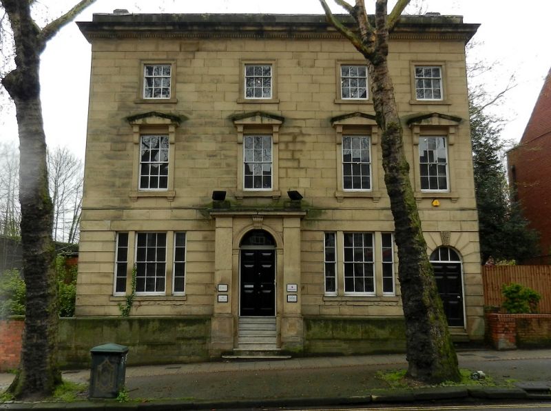
FRIAR GATE
1.
5170
(South Side)
No 93
SK 3436 SE 4/129
II
2.
Circa 1840. Stone; 3 storeys, the ground storey rusticated; 4 sash windows in
plain surrounds with bracketed cornices and sills; 2 tripartite window to ground
storey and semi-circular headed doorway and porch, voluted keyblock, 4-panelled
door, steps up; bold eaves, blocking course.
Listing NGR: SK3463036413
External links are from the relevant listing authority and, where applicable, Wikidata. Wikidata IDs may be related buildings as well as this specific building. If you want to add or update a link, you will need to do so by editing the Wikidata entry.


Other nearby listed buildings
