Approximate Location Map
Large Map »
Latitude: 50.996 / 50°59'45"N
Longitude: -0.7714 / 0°46'17"W
OS Eastings: 486311
OS Northings: 122558
OS Grid: SU863225
Mapcode National: GBR DDV.HRL
Mapcode Global: FRA 968H.38X
Plus Code: 9C2XX6WH+9C
Entry Name: 34 and 35, the Street
Listing Date: 18 June 1959
Grade: II
Source: Historic England
Source ID: 1217307
English Heritage Legacy ID: 412148
ID on this website: 101217307
Location: Stedham, Chichester, West Sussex, GU29
County: West Sussex
District: Chichester
Civil Parish: Stedham with Iping
Built-Up Area: Stedham
Traditional County: Sussex
Lieutenancy Area (Ceremonial County): West Sussex
Church of England Parish: Stedham with Iping
Church of England Diocese: Chichester
Tagged with: Building
SU 82 SE STEDHAM WITH IPING THE STREET
Stedham
11/22
Nos 34 & 35
18.5.59
- II
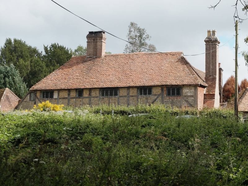
One building, now empty and neglected. Cl7 or earlier timber-framed building
with infilling of red brick and stone. Tiled roof. Casement windows. Chimney
breast on south west side with tiled offsets. Two storeys. Five windows.
Listing NGR: SU8631122558
External links are from the relevant listing authority and, where applicable, Wikidata. Wikidata IDs may be related buildings as well as this specific building. If you want to add or update a link, you will need to do so by editing the Wikidata entry.


Other nearby listed buildings
