Approximate Location Map
Large Map »
Latitude: 50.7126 / 50°42'45"N
Longitude: -2.4375 / 2°26'14"W
OS Eastings: 369207
OS Northings: 90417
OS Grid: SY692904
Mapcode National: GBR PY.RMTN
Mapcode Global: FRA 57S6.86Y
Plus Code: 9C2VPH77+22
Entry Name: South Terrace
Listing Date: 8 May 1975
Grade: II
Source: Historic England
Source ID: 1219933
English Heritage Legacy ID: 393792
ID on this website: 101219933
Location: Dorchester, Dorset, DT1
County: Dorset
Civil Parish: Dorchester
Built-Up Area: Dorchester
Traditional County: Dorset
Lieutenancy Area (Ceremonial County): Dorset
Church of England Parish: Dorchester and West Stafford
Church of England Diocese: Salisbury
Tagged with: Building
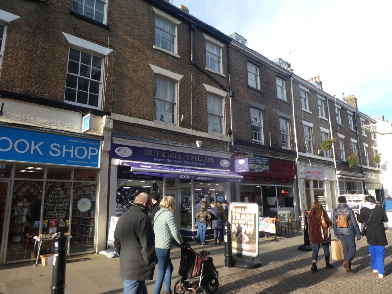
SOUTH STREET
l.
5l9l
(West Side)
South Terrace
[Nos 1 to 6 (consec)]
SY 6990 7/105
II GV
2.
Mid Cl9. Brick terrace of 6 houses. 3 storeys, attics and cellars. Each house
is 2 windowed and has 1 dormer. Cornice. Sash windows. Other houses have
poor modern shop- fronts inserted.
Nos 1 to 6 (consec)South Terrace, Nos 37 to 41 (consec), No 40A, No 41A and the
Post Office form a group.
Listing NGR: SY6920790417
External links are from the relevant listing authority and, where applicable, Wikidata. Wikidata IDs may be related buildings as well as this specific building. If you want to add or update a link, you will need to do so by editing the Wikidata entry.


Other nearby listed buildings
