Approximate Location Map
Large Map »
Latitude: 51.4143 / 51°24'51"N
Longitude: -1.3318 / 1°19'54"W
OS Eastings: 446566
OS Northings: 168577
OS Grid: SU465685
Mapcode National: GBR 81S.63Q
Mapcode Global: VHCZB.VQS5
Plus Code: 9C3WCM79+P7
Entry Name: Milestone Approximately 30 Metres to South of Donnington Hospital
Listing Date: 16 August 1983
Grade: II
Source: Historic England
Source ID: 1220454
English Heritage Legacy ID: 394179
ID on this website: 101220454
Location: Donnington, West Berkshire, RG14
County: West Berkshire
Civil Parish: Shaw cum Donnington
Built-Up Area: Newbury
Traditional County: Berkshire
Lieutenancy Area (Ceremonial County): Berkshire
Church of England Parish: Shaw cum Donnington
Church of England Diocese: Oxford
Tagged with: Milestone
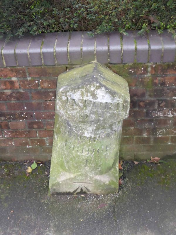
SU 46NE SHAW CUM DONNINGTON OXFORD ROAD
(west side)
7/53 Milestone approximately
30 metres to South of
Donnington hospital
GV II
Milestone. C18. Painted stone. Inscribed: 'Oxford 25'; and 'Newbury
Bridge 1'.
Listing NGR: SU4656668576
External links are from the relevant listing authority and, where applicable, Wikidata. Wikidata IDs may be related buildings as well as this specific building. If you want to add or update a link, you will need to do so by editing the Wikidata entry.


Other nearby listed buildings
