Approximate Location Map
Large Map »
Latitude: 50.8489 / 50°50'55"N
Longitude: -0.6074 / 0°36'26"W
OS Eastings: 498132
OS Northings: 106407
OS Grid: SU981064
Mapcode National: GBR FJ4.P8B
Mapcode Global: FRA 96MV.F6H
Plus Code: 9C2XR9XV+G2
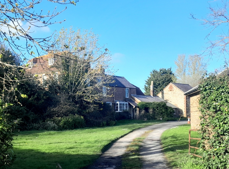
Entry Name: Church Farmhouse
Listing Date: 5 June 1958
Grade: II
Source: Historic England
Source ID: 1222198
English Heritage Legacy ID: 413984
ID on this website: 101222198
Location: Binsted, Arun, West Sussex, BN18
County: West Sussex
District: Arun
Civil Parish: Walberton
Traditional County: Sussex
Lieutenancy Area (Ceremonial County): West Sussex
Church of England Parish: Binsted
Church of England Diocese: Chichester
Tagged with: Farmhouse
SU 90NE TORTINGTON BINSTED LANE,
8/324 BINSTED
5.6.58
Church Farmhouse
II
C18. Two storeys and attic. Five windows. Two dormers. Red brick. hipped tiled
roof. Glazing bars intact. Doorway up five steps with iron handrail and banister on
each side and flat hood on brackets and door of six fielded panels.
Listing NGR: SU9813206407
External links are from the relevant listing authority and, where applicable, Wikidata. Wikidata IDs may be related buildings as well as this specific building. If you want to add or update a link, you will need to do so by editing the Wikidata entry.


Other nearby listed buildings
