Approximate Location Map
Large Map »
Latitude: 50.8525 / 50°51'9"N
Longitude: -0.5305 / 0°31'49"W
OS Eastings: 503537
OS Northings: 106916
OS Grid: TQ035069
Mapcode National: GBR GKK.JPB
Mapcode Global: FRA 96SV.74W
Plus Code: 9C2XVF39+2R
Entry Name: 219, the Street
Listing Date: 20 September 1984
Grade: II
Source: Historic England
Source ID: 1222540
English Heritage Legacy ID: 414749
ID on this website: 101222540
Location: Warningcamp, Arun, West Sussex, BN18
County: West Sussex
District: Arun
Civil Parish: Warningcamp
Traditional County: Sussex
Lieutenancy Area (Ceremonial County): West Sussex
Church of England Parish: Lyminster St Mary Magdalene
Church of England Diocese: Chichester
Tagged with: Building
TQ 00NW WARNINGCAMP THE STREET
9/207
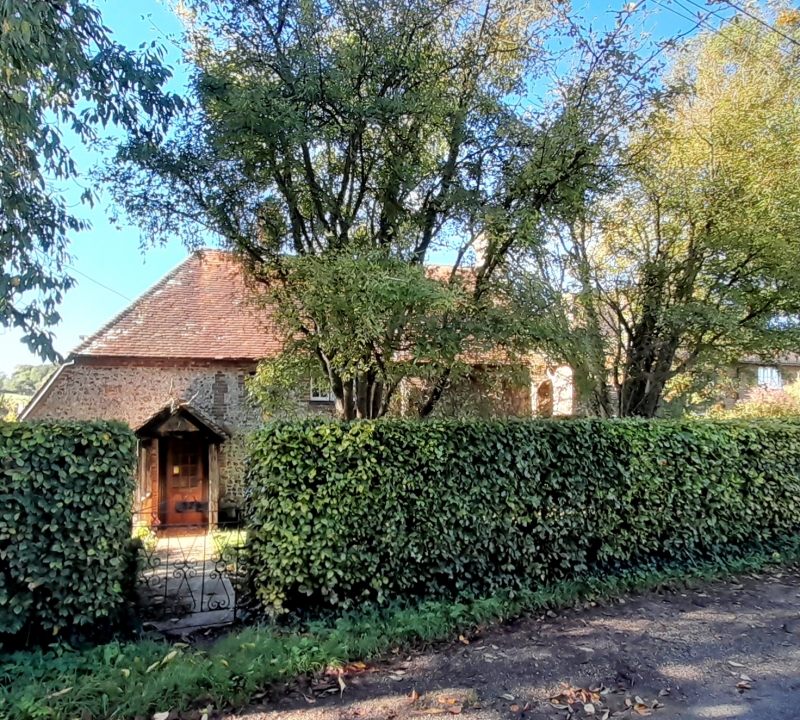
No. 219 Warningcamp
II
C18 or earlier. Two storeys. Two windows. Faced with flints with red brick
dressings, quoins and modillion eaves cornice. Tiled roof. Casement windows. Two
brick buttresses.
Listing NGR: TQ0353706916
External links are from the relevant listing authority and, where applicable, Wikidata. Wikidata IDs may be related buildings as well as this specific building. If you want to add or update a link, you will need to do so by editing the Wikidata entry.


Other nearby listed buildings
