Approximate Location Map
Large Map »
Latitude: 50.8542 / 50°51'15"N
Longitude: -0.5323 / 0°31'56"W
OS Eastings: 503405
OS Northings: 107106
OS Grid: TQ034071
Mapcode National: GBR GKK.B7J
Mapcode Global: FRA 96SV.0FZ
Plus Code: 9C2XVF39+M3
Entry Name: 223, the Street
Listing Date: 12 October 1954
Grade: II
Source: Historic England
Source ID: 1222543
English Heritage Legacy ID: 414754
ID on this website: 101222543
Location: Warningcamp, Arun, West Sussex, BN18
County: West Sussex
District: Arun
Civil Parish: Warningcamp
Traditional County: Sussex
Lieutenancy Area (Ceremonial County): West Sussex
Church of England Parish: Lyminster St Mary Magdalene
Church of England Diocese: Chichester
Tagged with: Building
TQ OONW WARNINGCAMP THE STREET
9/211
12.10.54 No. 223 Warningcamp
II
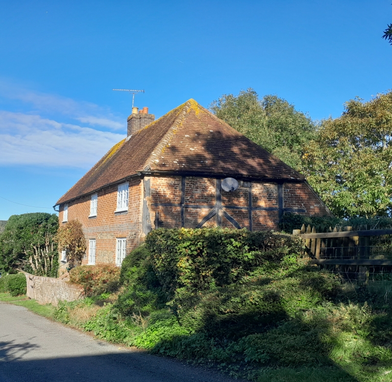
C17 or earlier timber framed cottage with the timbering exposed and red brick
infilling on the sides but refronted with red brick and flints. Flush stringcourse of
grey headers. Hipped tiled roof. Casement windows. Two storeys. Three windows.
Listing NGR: TQ0340507106
External links are from the relevant listing authority and, where applicable, Wikidata. Wikidata IDs may be related buildings as well as this specific building. If you want to add or update a link, you will need to do so by editing the Wikidata entry.


Other nearby listed buildings
