Approximate Location Map
Large Map »
Latitude: 50.7255 / 50°43'31"N
Longitude: -3.5379 / 3°32'16"W
OS Eastings: 291544
OS Northings: 92890
OS Grid: SX915928
Mapcode National: GBR P0.PXNT
Mapcode Global: FRA 37G5.CHN
Plus Code: 9C2RPFG6+5R
Entry Name: 25, St Davids Hill
Listing Date: 18 June 1974
Grade: II
Source: Historic England
Source ID: 1223324
English Heritage Legacy ID: 418989
ID on this website: 101223324
Location: Exeter, Devon, EX4
County: Devon
District: Exeter
Electoral Ward/Division: St David's
Parish: Non Civil Parish
Built-Up Area: Exeter
Traditional County: Devon
Lieutenancy Area (Ceremonial County): Devon
Church of England Parish: Exeter St David
Church of England Diocese: Exeter
Tagged with: Building
ST DAVID'S HILL
1.
1092
(West Side)
No 25
SX 9192 NE 2/118
II
2.
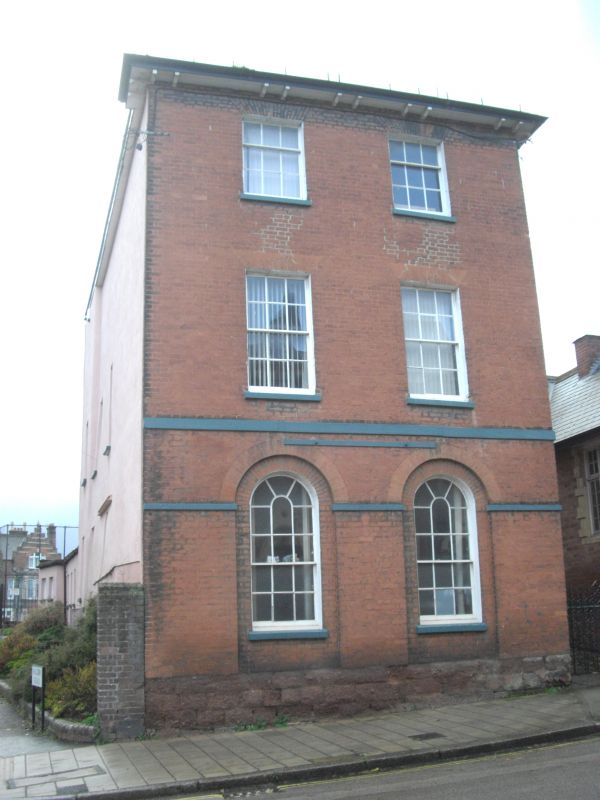
3 storey red brick house, circa 1805, with 2 window front to road. Round-headed
recessed ground floor windows. Patent stone bands, brackets to cornice. At side
is round-headed patent stone doorway of standard type. (See Colleton Crescent.)
Sash windows with glazing bars. Bracketted eaves, hipped slate roof.
Listing NGR: SX9153492896
External links are from the relevant listing authority and, where applicable, Wikidata. Wikidata IDs may be related buildings as well as this specific building. If you want to add or update a link, you will need to do so by editing the Wikidata entry.


Other nearby listed buildings
