Approximate Location Map
Large Map »
Latitude: 50.7656 / 50°45'56"N
Longitude: -1.2992 / 1°17'57"W
OS Eastings: 449519
OS Northings: 96460
OS Grid: SZ495964
Mapcode National: GBR 89K.VS0
Mapcode Global: FRA 8752.1PD
Plus Code: 9C2WQP82+78
Entry Name: Esplanade Wall
Listing Date: 9 August 1979
Grade: II
Source: Historic England
Source ID: 1223776
English Heritage Legacy ID: 419634
ID on this website: 101223776
Location: Cowes, Isle of Wight, PO31
County: Isle of Wight
Civil Parish: Cowes
Built-Up Area: Cowes
Traditional County: Hampshire
Lieutenancy Area (Ceremonial County): Isle of Wight
Church of England Parish: West Cowes Holy Trinity
Church of England Diocese: Portsmouth
Tagged with: Wall
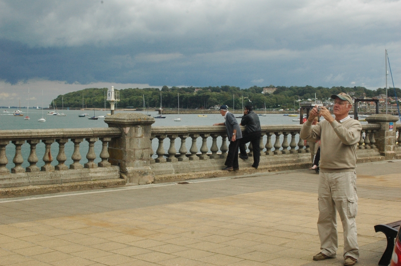
VICTCRIA PARADE
1.
5270
West Cowes
Esplanade Wall
SZ 4996 SE 1/108
SZ 49 NE 4/108
II GV
2.
Erected 1897 in Commemoration of Queen Victoria's Diamond Jubilee. Cemented
balustrading, about 3 ft in height with square piers at regular intervals.
Included for group value and interest as part of the esplanade improvements
of the 1890s.
Listing NGR: SZ4951996460
External links are from the relevant listing authority and, where applicable, Wikidata. Wikidata IDs may be related buildings as well as this specific building. If you want to add or update a link, you will need to do so by editing the Wikidata entry.


Other nearby listed buildings
