Approximate Location Map
Large Map »
Latitude: 50.9874 / 50°59'14"N
Longitude: -0.609 / 0°36'32"W
OS Eastings: 497731
OS Northings: 121811
OS Grid: SU977218
Mapcode National: GBR FGL.2VF
Mapcode Global: FRA 96MH.LL5
Plus Code: 9C2XX9PR+XC
Entry Name: The Institute
Listing Date: 22 February 1955
Grade: II
Source: Historic England
Source ID: 1224274
English Heritage Legacy ID: 420218
ID on this website: 101224274
Location: Petworth, Chichester, West Sussex, GU28
County: West Sussex
District: Chichester
Civil Parish: Petworth
Built-Up Area: Petworth
Traditional County: Sussex
Lieutenancy Area (Ceremonial County): West Sussex
Church of England Parish: Petworth St Mary
Church of England Diocese: Chichester
Tagged with: Architectural structure
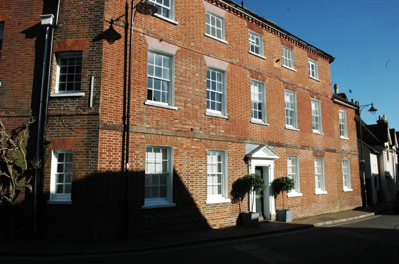
SU 9721 PETWORTH EAST STREET
(east side)
29/254 The Institute
22.2.55
GV II
House. C18. Three storeys. Five windows. Red brick. Stringcourse. Modillion
eaves cornice. Hipped tiled roof. Glazing bars intact. Doorway with pilasters and
pediment over. Later additions to south side.
Listing NGR: SU9773121811
External links are from the relevant listing authority and, where applicable, Wikidata. Wikidata IDs may be related buildings as well as this specific building. If you want to add or update a link, you will need to do so by editing the Wikidata entry.


Other nearby listed buildings
