Approximate Location Map
Large Map »
Latitude: 51.4964 / 51°29'47"N
Longitude: -0.1972 / 0°11'50"W
OS Eastings: 525239
OS Northings: 179040
OS Grid: TQ252790
Mapcode National: GBR C9.GXS
Mapcode Global: VHGQY.JNL6
Plus Code: 9C3XFRW3+H4
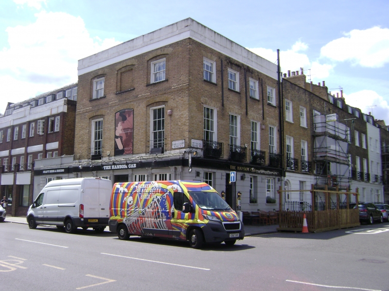
Entry Name: The Hansom Cab Public House
Listing Date: 15 April 1969
Grade: II
Source: Historic England
Source ID: 1225932
English Heritage Legacy ID: 422956
Also known as: The Hansom Cab
The Hansom Cab, Kensington
ID on this website: 101225932
Location: Earl's Court, Kensington and Chelsea, London, W8
County: London
District: Kensington and Chelsea
Electoral Ward/Division: Abingdon
Parish: Non Civil Parish
Built-Up Area: Kensington and Chelsea
Traditional County: Middlesex
Lieutenancy Area (Ceremonial County): Greater London
Church of England Parish: St Mary Abbots with Christ Church and St Philip Kensington
Church of England Diocese: London
Tagged with: Pub
TQ 2579 SW PEMBROKE SQUARE W8
36/16 (south side)
15.4.69 The Hansom Cab Public House
GV
II
'The Hansom Cab' public house stuccoed and altered. Listed for group value.
Listing NGR: TQ2523979040
External links are from the relevant listing authority and, where applicable, Wikidata. Wikidata IDs may be related buildings as well as this specific building. If you want to add or update a link, you will need to do so by editing the Wikidata entry.


Other nearby listed buildings
