Approximate Location Map
Large Map »
Latitude: 50.9856 / 50°59'8"N
Longitude: -0.6115 / 0°36'41"W
OS Eastings: 497556
OS Northings: 121606
OS Grid: SU975216
Mapcode National: GBR FGL.27B
Mapcode Global: FRA 96LH.ZHT
Plus Code: 9C2XX9PQ+69
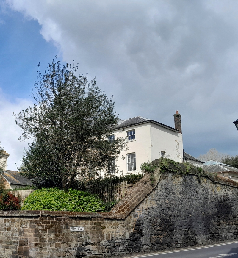
Entry Name: Culvercroft
Listing Date: 22 May 1985
Grade: II
Source: Historic England
Source ID: 1226208
English Heritage Legacy ID: 423353
ID on this website: 101226208
Location: Petworth, Chichester, West Sussex, GU28
County: West Sussex
District: Chichester
Civil Parish: Petworth
Built-Up Area: Petworth
Traditional County: Sussex
Lieutenancy Area (Ceremonial County): West Sussex
Church of England Parish: Petworth St Mary
Church of England Diocese: Chichester
Tagged with: Building
SU 9721 PETWORTH POUND STREET
(west side)
29/372
Culvercroft
II
House. Early C19. Two storeys. Three windows facing north, four windows facing
east. Stuccoed. Eaves cornice. Hipped slate roof. Glazing bars intact. Porch of
solid type with round-headed arch.
Listing NGR: SU9755621606
External links are from the relevant listing authority and, where applicable, Wikidata. Wikidata IDs may be related buildings as well as this specific building. If you want to add or update a link, you will need to do so by editing the Wikidata entry.


Other nearby listed buildings
