Approximate Location Map
Large Map »
Latitude: 50.9853 / 50°59'6"N
Longitude: -0.6111 / 0°36'39"W
OS Eastings: 497588
OS Northings: 121570
OS Grid: SU975215
Mapcode National: GBR FGL.2BR
Mapcode Global: FRA 96LH.ZQF
Plus Code: 9C2XX9PQ+4H
Entry Name: The Garden Wall of Boxgrove to the North of the House
Listing Date: 22 May 1985
Grade: II
Source: Historic England
Source ID: 1226305
English Heritage Legacy ID: 423346
ID on this website: 101226305
Location: Petworth, Chichester, West Sussex, GU28
County: West Sussex
District: Chichester
Civil Parish: Petworth
Built-Up Area: Petworth
Traditional County: Sussex
Lieutenancy Area (Ceremonial County): West Sussex
Church of England Parish: Petworth St Mary
Church of England Diocese: Chichester
Tagged with: Wall
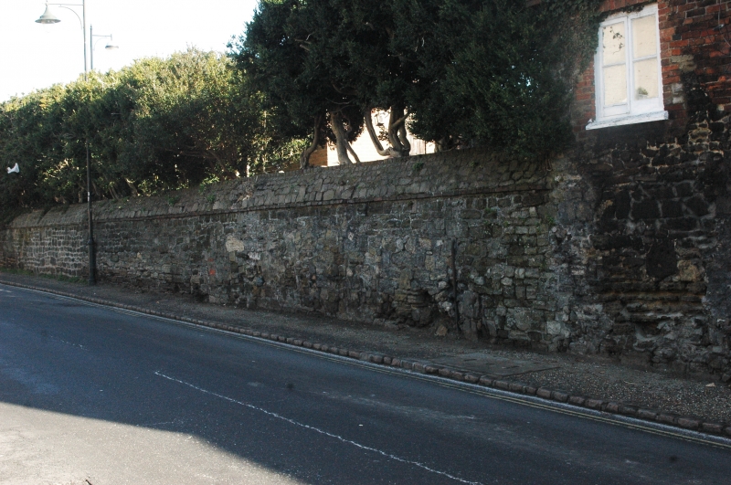
SU 9721 PETWORTH POUND STREET
(east side)
29/366A
The Garden Wall of
Boxgrove to the north
of the house
GV
II
Wall. C18. Stone rubble with curved stone coping. Listed for group value.
Listing NGR: SU9758821570
External links are from the relevant listing authority and, where applicable, Wikidata. Wikidata IDs may be related buildings as well as this specific building. If you want to add or update a link, you will need to do so by editing the Wikidata entry.


Other nearby listed buildings
