Approximate Location Map
Large Map »
Latitude: 50.9282 / 50°55'41"N
Longitude: -0.6092 / 0°36'33"W
OS Eastings: 497837
OS Northings: 115228
OS Grid: SU978152
Mapcode National: GBR FH5.NSY
Mapcode Global: FRA 96MN.6H2
Plus Code: 9C2XW9HR+78
Entry Name: Beckhall
Listing Date: 22 May 1985
Grade: II
Source: Historic England
Source ID: 1227118
English Heritage Legacy ID: 424737
ID on this website: 101227118
Location: Sutton, Chichester, West Sussex, RH20
County: West Sussex
District: Chichester
Civil Parish: Sutton
Built-Up Area: Sutton
Traditional County: Sussex
Lieutenancy Area (Ceremonial County): West Sussex
Church of England Parish: Sutton St John the Baptist with Bignor Holy Cross
Church of England Diocese: Chichester
Tagged with: Building
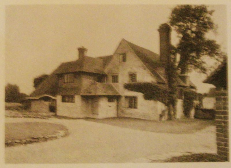
SU 9715 SUTTON THE STREET
(west side)
24/83
Beckhall
II
Once a farmhouse now a house. C17 or earlier L-shaped building. Two storeys and
attic in gable end. Five widows. Stone rubble, the first floor of the east wing
tile hung. Tiled roof. Casement windows.
Listing NGR: SU9783915229
External links are from the relevant listing authority and, where applicable, Wikidata. Wikidata IDs may be related buildings as well as this specific building. If you want to add or update a link, you will need to do so by editing the Wikidata entry.


Other nearby listed buildings
