Approximate Location Map
Large Map »
Latitude: 50.7234 / 50°43'24"N
Longitude: -3.2182 / 3°13'5"W
OS Eastings: 314105
OS Northings: 92233
OS Grid: SY141922
Mapcode National: GBR P9.DSN9
Mapcode Global: FRA 4745.J17
Plus Code: 9C2RPQFJ+8P
Entry Name: Cotford Bridge
Listing Date: 12 November 1973
Grade: II
Source: Historic England
Source ID: 1227807
English Heritage Legacy ID: 402259
ID on this website: 101227807
Location: Cotford, East Devon, EX10
County: Devon
District: East Devon
Civil Parish: Sidmouth
Traditional County: Devon
Lieutenancy Area (Ceremonial County): Devon
Church of England Parish: Sidbury with Sidford
Church of England Diocese: Exeter
Tagged with: Bridge
1.
1633
SY 19 SW
12/311
SIDBURY
Cotford Bridge
II
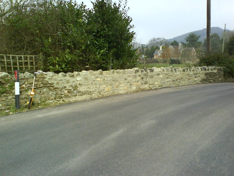
2.
C18 or possibly earlier. Stone rubble and some flint. Small semicircular
arch with voussoirs. Plain rubble parapets partly renewed.
Listing NGR: SY1410592233
External links are from the relevant listing authority and, where applicable, Wikidata. Wikidata IDs may be related buildings as well as this specific building. If you want to add or update a link, you will need to do so by editing the Wikidata entry.


Other nearby listed buildings
