Approximate Location Map
Large Map »
Latitude: 53.5737 / 53°34'25"N
Longitude: -2.662 / 2°39'43"W
OS Eastings: 356261
OS Northings: 408770
OS Grid: SD562087
Mapcode National: GBR 9WV3.HN
Mapcode Global: WH97R.2FNP
Plus Code: 9C5VH8FQ+F6
Entry Name: Cross Base in Bank
Listing Date: 10 May 1988
Grade: II
Source: Historic England
Source ID: 1228475
English Heritage Legacy ID: 403075
Also known as: Cross base on Standish Wood Lane 700m south east of Standish Hall
ID on this website: 101228475
Location: Wigan, Greater Manchester, WN6
County: Wigan
Electoral Ward/Division: Shevington with Lower Ground
Parish: Non Civil Parish
Traditional County: Lancashire
Lieutenancy Area (Ceremonial County): Greater Manchester
Church of England Parish: Standish St Wilfrid
Church of England Diocese: Blackburn
Tagged with: Cross base
STANDISH-WITH-LANGTREE STANDISH WOOD LANE
SD 51 SE
SD 562 067 (east side)
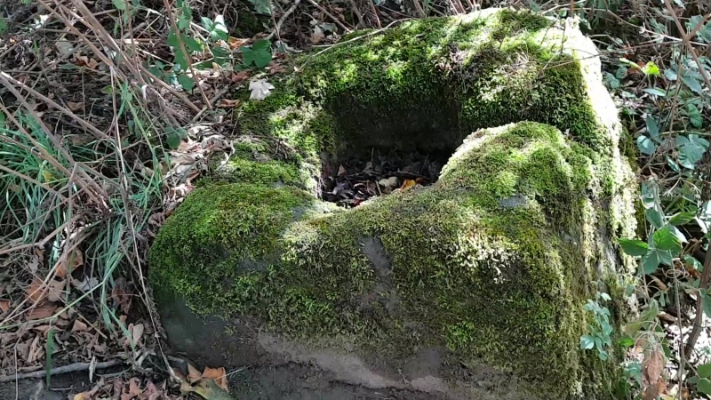
5/127 Cross base in
- bank
- II
Cross base. Probably medieval. Stone. 650mm sides. Large
square socket.
Listing NGR: SD5626108770
External links are from the relevant listing authority and, where applicable, Wikidata. Wikidata IDs may be related buildings as well as this specific building. If you want to add or update a link, you will need to do so by editing the Wikidata entry.


Other nearby listed buildings
