Approximate Location Map
Large Map »
Latitude: 50.8288 / 50°49'43"N
Longitude: -0.857 / 0°51'25"W
OS Eastings: 480592
OS Northings: 103870
OS Grid: SU805038
Mapcode National: GBR CFC.S66
Mapcode Global: FRA 962X.5X7
Plus Code: 9C2XR4HV+G5
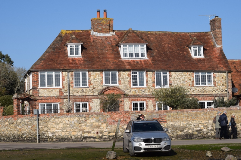
Entry Name: Chandler's House
Listing Date: 28 January 1986
Grade: II
Source: Historic England
Source ID: 1229816
English Heritage Legacy ID: 300656
ID on this website: 101229816
Location: Bosham, Chichester, West Sussex, PO18
County: West Sussex
District: Chichester
Civil Parish: Bosham
Built-Up Area: Bosham
Traditional County: Sussex
Lieutenancy Area (Ceremonial County): West Sussex
Church of England Parish: Bosham Holy Trinity
Church of England Diocese: Chichester
Tagged with: House
BOSHAM SHORE ROAD
SU 8003/8103 (north side)
29/596 Chandler's House
-
- II
Formerly known as 'The Town Hall'. Dated 1694 but much restored. Two
storeys and attic. Five windows. Three hipped dormers. Stone rubble with
red brick dressings and quoins. Hipped tiled roof. Modern casement windows.
Listing NGR: SU8059203870
External links are from the relevant listing authority and, where applicable, Wikidata. Wikidata IDs may be related buildings as well as this specific building. If you want to add or update a link, you will need to do so by editing the Wikidata entry.


Other nearby listed buildings
