Approximate Location Map
Large Map »
Latitude: 53.0902 / 53°5'24"N
Longitude: -2.7691 / 2°46'8"W
OS Eastings: 348588
OS Northings: 355054
OS Grid: SJ485550
Mapcode National: GBR 7G.9CW4
Mapcode Global: WH88W.FLMB
Plus Code: 9C5V36RJ+39
Entry Name: Halfway House Milestone
Listing Date: 22 March 1988
Grade: II
Source: Historic England
Source ID: 1230266
English Heritage Legacy ID: 405190
ID on this website: 101230266
Location: Barnhill, Cheshire West and Chester, Cheshire, CH3
County: Cheshire West and Chester
Civil Parish: Broxton
Traditional County: Cheshire
Lieutenancy Area (Ceremonial County): Cheshire
Church of England Parish: Tattenhall St Alban
Church of England Diocese: Chester
Tagged with: Milestone
5/50 SJ45NE (5857 5505)
BROXTON C.P.
BARNHILL
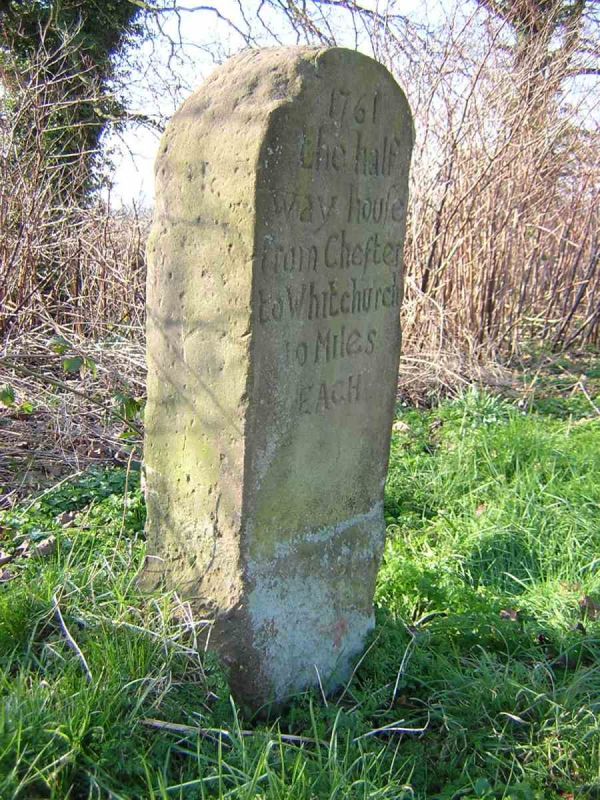
Halfway House Milestone
II
Milestone, 1761. Red Bunter sandstone. A substantial slab of stone one metre
high which is inscribed "1761 the halfway house from Chester to Whitchurch 10 miles
EACH." The inscription has been re-cut c1987.
Listing NGR: SJ 48588 55054
External links are from the relevant listing authority and, where applicable, Wikidata. Wikidata IDs may be related buildings as well as this specific building. If you want to add or update a link, you will need to do so by editing the Wikidata entry.


Other nearby listed buildings
