Approximate Location Map
Large Map »
Latitude: 51.7546 / 51°45'16"N
Longitude: -1.2559 / 1°15'21"W
OS Eastings: 451460
OS Northings: 206476
OS Grid: SP514064
Mapcode National: GBR 8YY.TKR
Mapcode Global: VHCXV.55X7
Plus Code: 9C3WQP3V+RJ
Entry Name: Trinity College, Kettell Hall
Listing Date: 12 January 1954
Grade: II*
Source: Historic England
Source ID: 1230901
English Heritage Legacy ID: 405937
ID on this website: 101230901
Location: Oxford, Oxfordshire, OX1
County: Oxfordshire
District: Oxford
Electoral Ward/Division: Carfax
Parish: Non Civil Parish
Built-Up Area: Oxford
Traditional County: Oxfordshire
Lieutenancy Area (Ceremonial County): Oxfordshire
Church of England Parish: Oxford St Mary Magdalen
Church of England Diocese: Oxford
Tagged with: Architectural structure
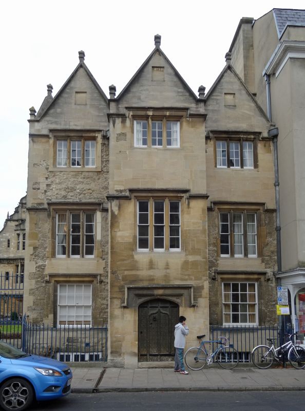
TRINITY COLLEGE
1.
1485
Front Quadrangle
Kettell Hall
SP 5106 SW 8/139G 12.1.54.
II*
2.
On South East and facing Broad Street. Circa 1618-20. 3 storeyed stone
house of the "passage" type with a projecting porch and 3 gables on South.
See RCHM pll4 and plans in Antiq Jnl XXVII (1947), 142.
Listing NGR: SP5146006476
External links are from the relevant listing authority and, where applicable, Wikidata. Wikidata IDs may be related buildings as well as this specific building. If you want to add or update a link, you will need to do so by editing the Wikidata entry.


Other nearby listed buildings
