Approximate Location Map
Large Map »
Latitude: 51.1433 / 51°8'35"N
Longitude: 0.9548 / 0°57'17"E
OS Eastings: 606778
OS Northings: 142377
OS Grid: TR067423
Mapcode National: GBR SYB.86X
Mapcode Global: VHKKP.HJMD
Plus Code: 9F324XV3+8W
Entry Name: Brabourne End
Listing Date: 16 February 1989
Grade: II
Source: Historic England
Source ID: 1232930
English Heritage Legacy ID: 408313
ID on this website: 101232930
Location: Ashford, Kent, TN25
County: Kent
District: Ashford
Civil Parish: Brook
Traditional County: Kent
Lieutenancy Area (Ceremonial County): Kent
Tagged with: Architectural structure
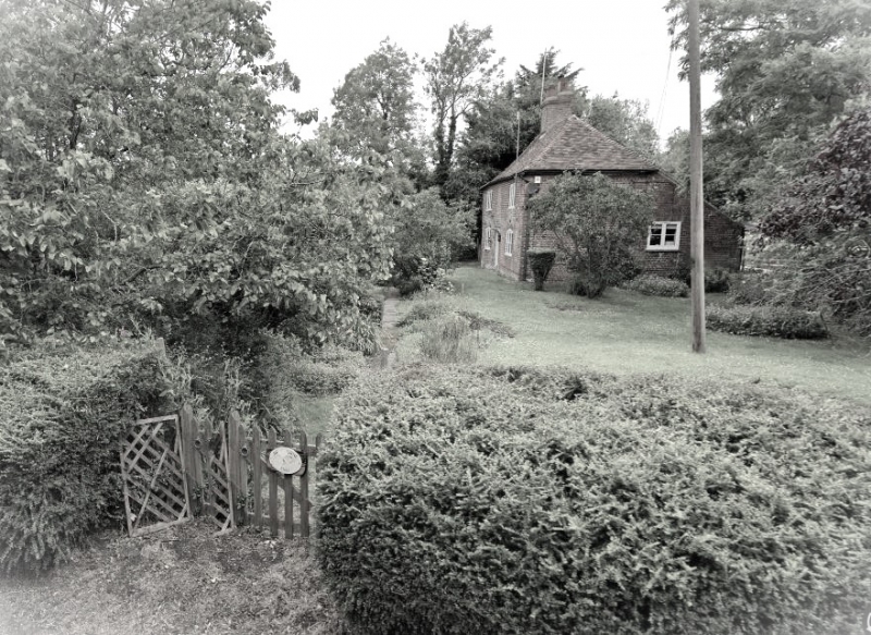
TR 04 SE BROOK PLUMPTON LANE
(north side)
4/48 Brabourne End
II
House. C18. Red brick and plain tiled roof. Two storeys and hipped
roof with large central stack. Two wooden casements on each floor,
those on ground floor with segmental heads. Central boarded door in
moulded surround with flat hood on brackets. Catslide outshot to
rear.
Listing NGR: TR0678142380
External links are from the relevant listing authority and, where applicable, Wikidata. Wikidata IDs may be related buildings as well as this specific building. If you want to add or update a link, you will need to do so by editing the Wikidata entry.


Other nearby listed buildings
