Approximate Location Map
Large Map »
Latitude: 50.9911 / 50°59'27"N
Longitude: 0.5244 / 0°31'27"E
OS Eastings: 577257
OS Northings: 124331
OS Grid: TQ772243
Mapcode National: GBR PVJ.TMF
Mapcode Global: FRA C6ZH.J3D
Plus Code: 9F22XGRF+CP
Entry Name: Udiam Farmhouse
Listing Date: 3 August 1961
Grade: II
Source: Historic England
Source ID: 1233850
English Heritage Legacy ID: 409436
ID on this website: 101233850
Location: Rother, East Sussex, TN32
County: East Sussex
District: Rother
Civil Parish: Ewhurst
Traditional County: Sussex
Lieutenancy Area (Ceremonial County): East Sussex
Church of England Parish: Ewhurst St James the Great
Church of England Diocese: Chichester
Tagged with: Farmhouse
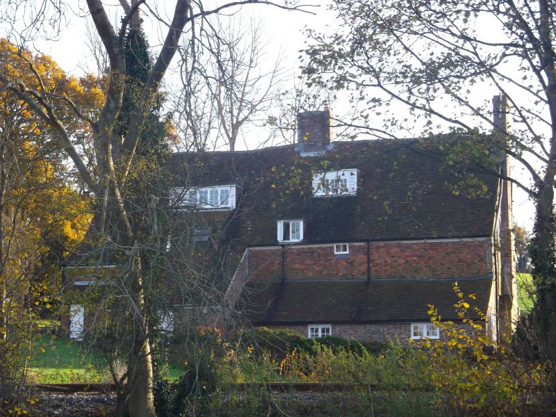
TQ 72 SE EWHURST JUNCTION ROAD
13/14 Udiam Farmhouse
3.8.61
II
C18 exterior but said to contain a medieval timber-framed aisled hall. Two
storeys, attic and semi-basement at west end. Four windows. Two gabled dormers.
Ground floor red brick, above tile-hung. Tiled roof. Glazing bars intact.
Doorway with flat hood on brackets and door of six fielded panels.
Listing NGR: TQ7725724331
External links are from the relevant listing authority and, where applicable, Wikidata. Wikidata IDs may be related buildings as well as this specific building. If you want to add or update a link, you will need to do so by editing the Wikidata entry.


Other nearby listed buildings
