Approximate Location Map
Large Map »
Latitude: 50.4314 / 50°25'53"N
Longitude: -3.6907 / 3°41'26"W
OS Eastings: 280013
OS Northings: 60431
OS Grid: SX800604
Mapcode National: GBR QL.MCHT
Mapcode Global: FRA 374X.CZ9
Plus Code: 9C2RC8J5+HP
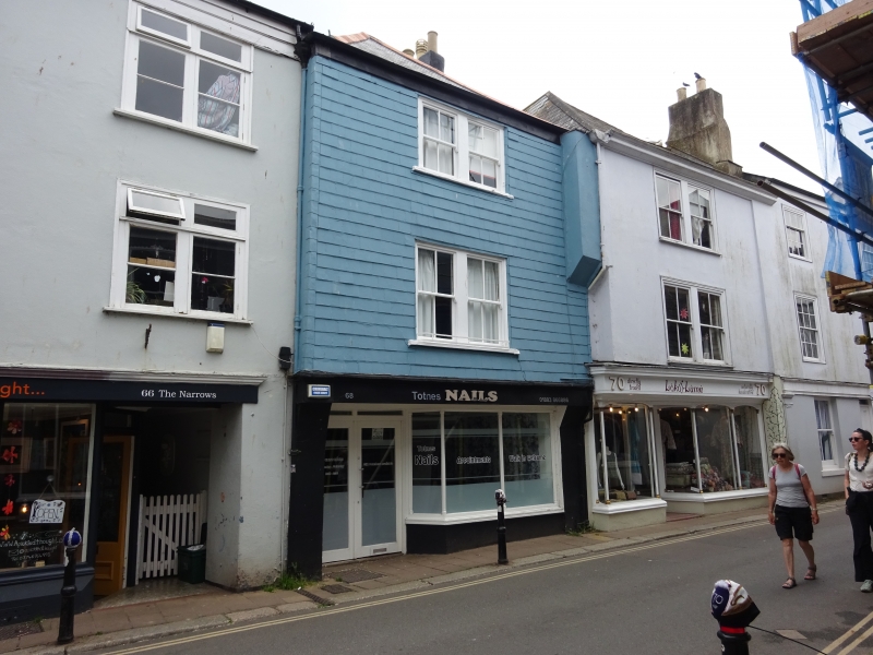
Entry Name: 68, High Street
Listing Date: 25 March 1969
Grade: II
Source: Historic England
Source ID: 1236388
English Heritage Legacy ID: 427353
ID on this website: 101236388
Location: Totnes, South Hams, Devon, TQ9
County: Devon
District: South Hams
Civil Parish: Totnes
Built-Up Area: Totnes
Traditional County: Devon
Lieutenancy Area (Ceremonial County): Devon
Church of England Parish: Totnes St Mary
Church of England Diocese: Exeter
Tagged with: Building
1.
5180 HIGH STREET
(South Side)
No 68
SX 8060 SW 1/58B 25.3.69.
II GV
2.
Mid C19. 3 storeys. 2 paired windows. Hipped, corrugated cement sheet roof.
Timber-framed, slate-hung front. Plain eaves band. Recessed sash windows.
Shopfront with wooden boxed-out entablature. Shop window with columnette Mullions.
Listing NGR: SX8001360431
External links are from the relevant listing authority and, where applicable, Wikidata. Wikidata IDs may be related buildings as well as this specific building. If you want to add or update a link, you will need to do so by editing the Wikidata entry.


Other nearby listed buildings
