Approximate Location Map
Large Map »
Latitude: 50.4294 / 50°25'45"N
Longitude: -3.6839 / 3°41'1"W
OS Eastings: 280496
OS Northings: 60195
OS Grid: SX804601
Mapcode National: GBR QM.TF8V
Mapcode Global: FRA 375X.GN7
Plus Code: 9C2RC8H8+QF
Entry Name: 22-25, Warland
Listing Date: 16 March 1978
Grade: II
Source: Historic England
Source ID: 1236980
English Heritage Legacy ID: 428106
ID on this website: 101236980
Location: Totnes, South Hams, Devon, TQ9
County: Devon
District: South Hams
Civil Parish: Totnes
Built-Up Area: Totnes
Traditional County: Devon
Lieutenancy Area (Ceremonial County): Devon
Church of England Parish: Totnes St Mary
Church of England Diocese: Exeter
Tagged with: Building
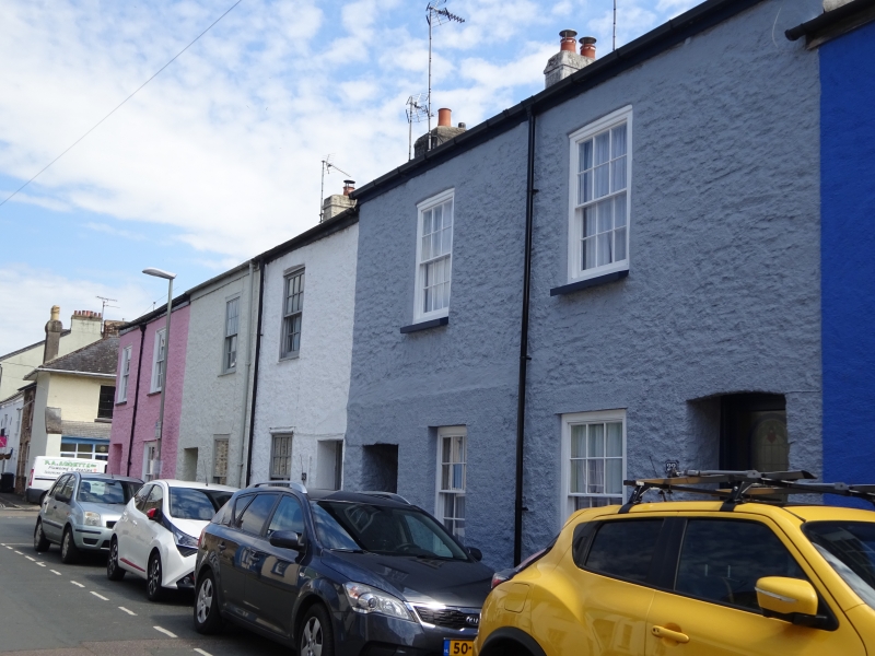
1.
5180 WARLAND
(East Side)
Nos 22 to 25 (consec)
SX 8060
SX 8060 SW
SX 8060 SE 2,4/235
II GV
2.
Early C19 row of cottages. 2 storeys. 1 or 2 windows each. Modern asbestos and
corrugated iron roofs. Rendered fronts. Recessed sash windows with glazing bars
(except No 24). Recessed doorways, most with panelled doors. No 24 included for
group value.
Listing NGR: SX8049660194
External links are from the relevant listing authority and, where applicable, Wikidata. Wikidata IDs may be related buildings as well as this specific building. If you want to add or update a link, you will need to do so by editing the Wikidata entry.


Other nearby listed buildings
