Approximate Location Map
Large Map »
Latitude: 50.8209 / 50°49'15"N
Longitude: -0.6143 / 0°36'51"W
OS Eastings: 497703
OS Northings: 103292
OS Grid: SU977032
Mapcode National: GBR FJJ.FHQ
Mapcode Global: FRA 96LX.QH7
Plus Code: 9C2XR9CP+97
Entry Name: Wall to Dyers Croft
Listing Date: 8 August 1988
Grade: II
Source: Historic England
Source ID: 1237842
English Heritage Legacy ID: 415155
ID on this website: 101237842
Location: Yapton, Arun, West Sussex, BN18
County: West Sussex
District: Arun
Civil Parish: Yapton
Built-Up Area: Yapton
Traditional County: Sussex
Lieutenancy Area (Ceremonial County): West Sussex
Church of England Parish: Yapton St Mary
Church of England Diocese: Chichester
Tagged with: Wall
The following building shall be added to the list:
SU 90 SE YAPTON MAIN ROAD
15/436 Wall to Dyers Croft
GV II
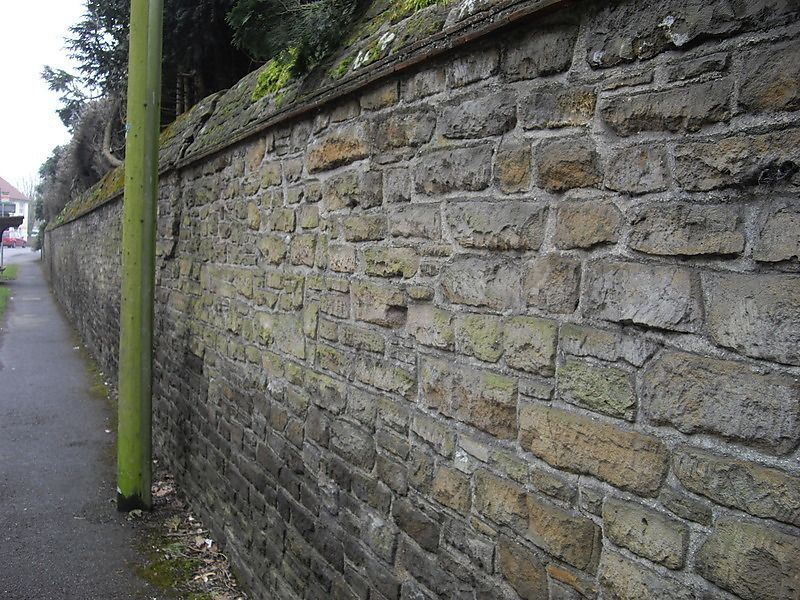
Garden wall 1938-9. Built of carved sandstone rubble. Almost 6 feet high with
triangular stone coping. To the west are 2 circular taller sandstone rubble
gatepiers and a further pair to the south linked by sections of walling and
with wrought iron gate.
Listing NGR: SU9770303292
External links are from the relevant listing authority and, where applicable, Wikidata. Wikidata IDs may be related buildings as well as this specific building. If you want to add or update a link, you will need to do so by editing the Wikidata entry.


Other nearby listed buildings
