Approximate Location Map
Large Map »
Latitude: 51.7459 / 51°44'45"N
Longitude: -2.2172 / 2°13'1"W
OS Eastings: 385101
OS Northings: 205261
OS Grid: SO851052
Mapcode National: GBR 1MK.J89
Mapcode Global: VH94Y.JC6Z
Plus Code: 9C3VPQWM+84
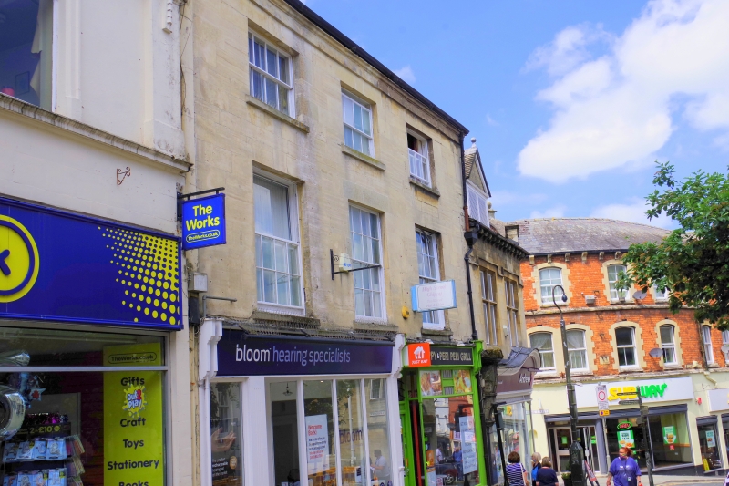
Entry Name: 2, 3 and 3A, High Street
Listing Date: 25 June 1974
Grade: II
Source: Historic England
Source ID: 1238224
English Heritage Legacy ID: 415667
ID on this website: 101238224
Location: Stroud, Gloucestershire, GL5
County: Gloucestershire
District: Stroud
Civil Parish: Stroud
Built-Up Area: Stroud
Traditional County: Gloucestershire
Lieutenancy Area (Ceremonial County): Gloucestershire
Church of England Parish: Stroud St Laurence
Church of England Diocese: Gloucester
Tagged with: Building
1. HIGH STREET
5227
(South Side)
Nos 2, 3 & 3A
SO 8505 5/299
II
2. .
Late C18. Ashlar. Pitched slate roof. 3 storeys. 3 ranges of double-hung
sashes with glazing bars. Ground floor modern, except for 1 6-panel door with
moulded lintel and fanlight, 1 pane of which has figure "3" in florid gilt type.
Listing NGR: SO8510105261
External links are from the relevant listing authority and, where applicable, Wikidata. Wikidata IDs may be related buildings as well as this specific building. If you want to add or update a link, you will need to do so by editing the Wikidata entry.


Other nearby listed buildings
