Approximate Location Map
Large Map »
Latitude: 51.082 / 51°4'55"N
Longitude: -0.5177 / 0°31'3"W
OS Eastings: 503925
OS Northings: 132455
OS Grid: TQ039324
Mapcode National: GBR GGW.1Y1
Mapcode Global: FRA 96T8.64V
Plus Code: 9C3X3FJJ+RW
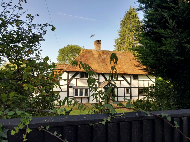
Entry Name: Chestnut Mead
Listing Date: 22 May 1985
Grade: II
Source: Historic England
Source ID: 1239743
English Heritage Legacy ID: 417727
ID on this website: 101239743
Location: Alfold Bars, Chichester, West Sussex, RH14
County: West Sussex
District: Chichester
Civil Parish: Loxwood
Traditional County: Sussex
Lieutenancy Area (Ceremonial County): West Sussex
Church of England Parish: Alfold and Loxwood
Church of England Diocese: Guildford
Tagged with: Architectural structure
TQ 03 SW LOXWOOD GUILDFORD ROAD
3/648 Chestnut Mead
II
Cottage. C17 or earlier timber-framed building with plaster infilling and curved
braces on first floor. Hipped tiled roof. Casement windows. Two storeys. Two
windows.
Listing NGR: TQ0392532455
External links are from the relevant listing authority and, where applicable, Wikidata. Wikidata IDs may be related buildings as well as this specific building. If you want to add or update a link, you will need to do so by editing the Wikidata entry.


Other nearby listed buildings
