Approximate Location Map
Large Map »
Latitude: 54.4039 / 54°24'14"N
Longitude: -1.7425 / 1°44'33"W
OS Eastings: 416811
OS Northings: 500971
OS Grid: NZ168009
Mapcode National: GBR JK8J.K2
Mapcode Global: WHC6D.6KHQ
Plus Code: 9C6WC734+HX
Entry Name: 36, Newbiggin
Listing Date: 15 October 1973
Grade: II
Source: Historic England
Source ID: 1240959
English Heritage Legacy ID: 439437
ID on this website: 101240959
Location: Friars' Closes, North Yorkshire, DL10
County: North Yorkshire
District: Richmondshire
Civil Parish: Richmond
Built-Up Area: Richmond
Traditional County: Yorkshire
Lieutenancy Area (Ceremonial County): North Yorkshire
Church of England Parish: Richmond with Holy Trinity with Hudswell
Church of England Diocese: Leeds
Tagged with: Building
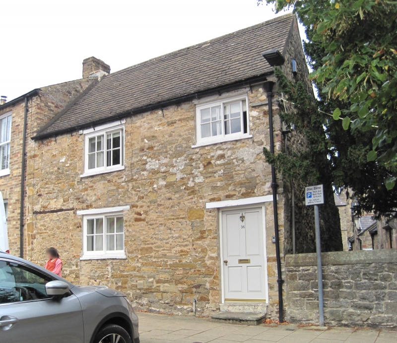
1. NEWBIGGIN
1549 (North Side)
No 36
NZ 1600 NE 5/201
II
2.
C18 cottage in uncoursed rubble. New slate roof. Two storeys. Two windows,
three-light modern casements, with wood lintels on ground floor. C19
door of four panels under wood lintel.
Listing NGR: NZ1681100971
External links are from the relevant listing authority and, where applicable, Wikidata. Wikidata IDs may be related buildings as well as this specific building. If you want to add or update a link, you will need to do so by editing the Wikidata entry.


Other nearby listed buildings
