Approximate Location Map
Large Map »
Latitude: 54.4025 / 54°24'8"N
Longitude: -1.7369 / 1°44'12"W
OS Eastings: 417174
OS Northings: 500809
OS Grid: NZ171008
Mapcode National: GBR JK9J.RM
Mapcode Global: WHC6D.9L4V
Plus Code: 9C6WC727+X6
Entry Name: Cobble Stones on Roadway
Listing Date: 15 October 1973
Grade: II
Source: Historic England
Source ID: 1241002
English Heritage Legacy ID: 439602
ID on this website: 101241002
Location: Richmond, North Yorkshire, DL10
County: North Yorkshire
District: Richmondshire
Civil Parish: Richmond
Built-Up Area: Richmond
Traditional County: Yorkshire
Lieutenancy Area (Ceremonial County): North Yorkshire
Church of England Parish: Richmond with Holy Trinity with Hudswell
Church of England Diocese: Leeds
Tagged with: Architectural structure
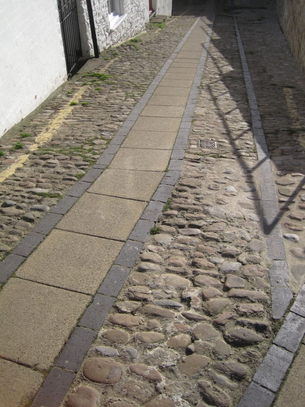
1. TOWER STREET
1549 ------------
Cobble stones on
roadway
NZ 1700 NW 1/415
II GV
2.
Cobble Roadway.
The Cobbled Roadway forms a group with the listed buildings in Tower Street
Listing NGR: NZ1717400809
External links are from the relevant listing authority and, where applicable, Wikidata. Wikidata IDs may be related buildings as well as this specific building. If you want to add or update a link, you will need to do so by editing the Wikidata entry.


Other nearby listed buildings
