Approximate Location Map
Large Map »
Latitude: 51.4211 / 51°25'15"N
Longitude: -1.728 / 1°43'40"W
OS Eastings: 419011
OS Northings: 169152
OS Grid: SU190691
Mapcode National: GBR 4X2.V84
Mapcode Global: VHC1P.0JBZ
Plus Code: 9C3WC7CC+CR
Entry Name: 13, the Parade
Listing Date: 21 October 1974
Grade: II
Source: Historic England
Source ID: 1243050
English Heritage Legacy ID: 446497
ID on this website: 101243050
Location: Marlborough, Wiltshire, SN8
County: Wiltshire
Civil Parish: Marlborough
Built-Up Area: Marlborough
Traditional County: Wiltshire
Lieutenancy Area (Ceremonial County): Wiltshire
Tagged with: Building
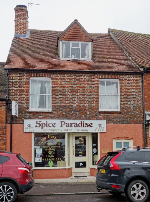
THE PARADE
1.
5407
(East Side)
No 13
SU 1969 1/284
II
2.
Cl8. Chequer brick. Ground floor rendered. Pitched old tile roof. Tall brick
stack. 2 storeys and attics. Brick modillion eaves cornice. Ground floor modern.
lst floor has 2 sashes with glazing bars, 1 C19 attic dormer.
Listing NGR: SU1900369156
External links are from the relevant listing authority and, where applicable, Wikidata. Wikidata IDs may be related buildings as well as this specific building. If you want to add or update a link, you will need to do so by editing the Wikidata entry.


Other nearby listed buildings
