Approximate Location Map
Large Map »
Latitude: 51.0903 / 51°5'25"N
Longitude: -1.8129 / 1°48'46"W
OS Eastings: 413199
OS Northings: 132350
OS Grid: SU131323
Mapcode National: GBR 510.JH9
Mapcode Global: FRA 7627.RJN
Plus Code: 9C3W35RP+4R
Entry Name: Post Office and Shop
Listing Date: 12 October 1972
Grade: II
Source: Historic England
Source ID: 1243251
English Heritage Legacy ID: 446906
ID on this website: 101243251
Location: Stratford sub Castle, Wiltshire, SP1
County: Wiltshire
Civil Parish: Salisbury
Built-Up Area: Salisbury
Traditional County: Wiltshire
Lieutenancy Area (Ceremonial County): Wiltshire
Church of England Parish: Stratford sub Castle St Lawrence
Church of England Diocese: Salisbury
Tagged with: Post office Thatched building
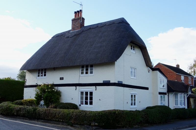
STRATFORD ROAD
1.
1594 Post Office and shop
SU 1332 12/579
II
2.
Early C18. 2 storeys, oolounmshed brick on projecting plinth, moulded string.
Half hipped thatched roof. East front has 2 3 light casements both floors.
North front has one casement and modern glazed and panelled door. Small single
storey shop as wing to north.
Listing NGR: SU1319932350
External links are from the relevant listing authority and, where applicable, Wikidata. Wikidata IDs may be related buildings as well as this specific building. If you want to add or update a link, you will need to do so by editing the Wikidata entry.


Other nearby listed buildings
