Approximate Location Map
Large Map »
Latitude: 51.2789 / 51°16'43"N
Longitude: 0.1327 / 0°7'57"E
OS Eastings: 548842
OS Northings: 155462
OS Grid: TQ488554
Mapcode National: GBR LLJ.QCZ
Mapcode Global: VHHPR.73ZY
Plus Code: 9F3274HM+G3
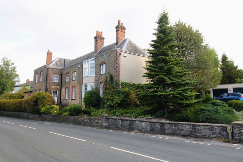
Entry Name: Retaining Wall and Terrace in Front of Nos 29-33 Odd
Listing Date: 2 July 1974
Grade: II
Source: Historic England
Source ID: 1243962
English Heritage Legacy ID: 448445
ID on this website: 101243962
Location: Sundridge, Sevenoaks, Kent, TN14
County: Kent
District: Sevenoaks
Civil Parish: Sundridge with Ide Hill
Built-Up Area: Sundridge
Traditional County: Kent
Lieutenancy Area (Ceremonial County): Kent
Church of England Parish: Sundridge St Mary
Church of England Diocese: Rochester
Tagged with: Retaining wall
1.
5280 SUNDRIDGE SUNDRIDGE
Main Road
(South Side)
Retaining wall and terrace
in front of Nos 29 to 33 (odd)
TQ 4855 32/1278 2.7.74.
II
2.
C18 random stone retaining wall in front bordering on road. 12 steps up to
terrace with C18 cast iron railings.
Listing NGR: TQ4884255462
External links are from the relevant listing authority and, where applicable, Wikidata. Wikidata IDs may be related buildings as well as this specific building. If you want to add or update a link, you will need to do so by editing the Wikidata entry.


Other nearby listed buildings
