Approximate Location Map
Large Map »
Latitude: 51.3059 / 51°18'21"N
Longitude: 0.2291 / 0°13'44"E
OS Eastings: 555478
OS Northings: 158664
OS Grid: TQ554586
Mapcode National: GBR VS.GG1
Mapcode Global: VHHPL.XFHS
Plus Code: 9F32864H+8M
Entry Name: K6 Telephone Kiosk
Listing Date: 11 January 1989
Grade: II
Source: Historic England
Source ID: 1244251
English Heritage Legacy ID: 449166
ID on this website: 101244251
Location: Kemsing, Sevenoaks, Kent, TN15
County: Kent
District: Sevenoaks
Civil Parish: Kemsing
Built-Up Area: Otford
Traditional County: Kent
Lieutenancy Area (Ceremonial County): Kent
Church of England Parish: Kemsing St Mary the Virgin
Church of England Diocese: Rochester
Tagged with: K6 telephone box
This list entry was subject to a Minor Amendment on 19/03/2014
TQ 5458-5558
16/590
KEMSING
ST EDITHS ROAD
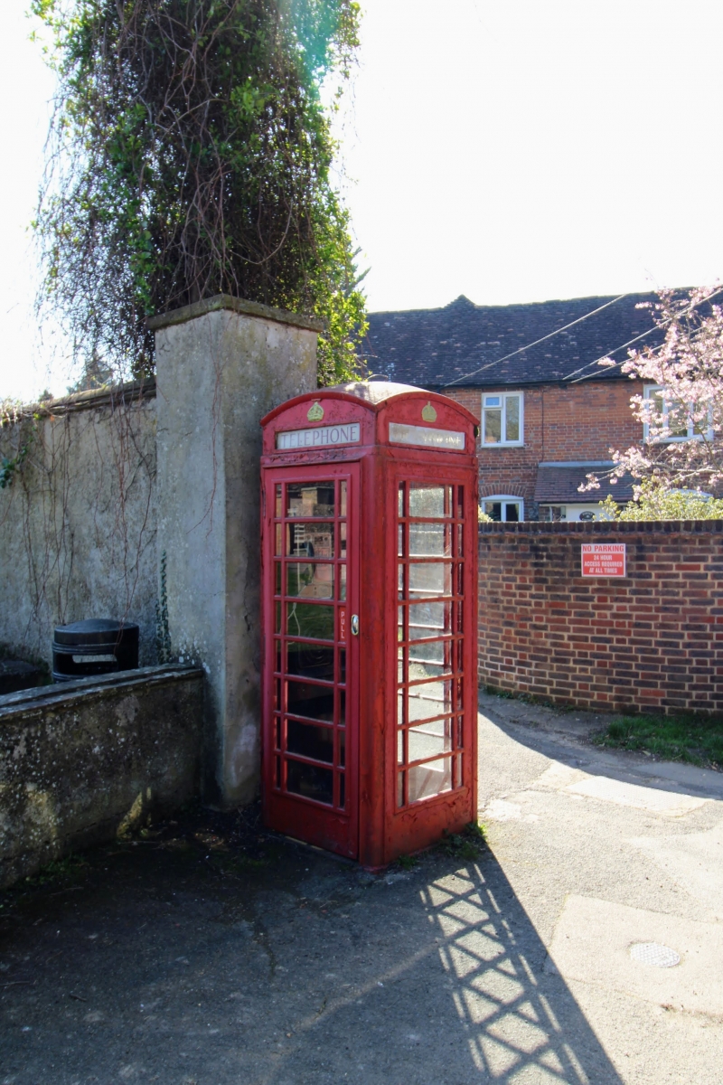
K6 Telephone Kiosk
II
Telephone kiosk. Type K6. Designed 1935 by Sir Giles Gilbert Scott. Made by
various contractors. Cast iron. Square kiosk with domed roof. Unperforated crowns
to top panels and margin glazing to windows and door.
Listing NGR: TQ5547858664
External links are from the relevant listing authority and, where applicable, Wikidata. Wikidata IDs may be related buildings as well as this specific building. If you want to add or update a link, you will need to do so by editing the Wikidata entry.


Other nearby listed buildings
