Approximate Location Map
Large Map »
Latitude: 54.432 / 54°25'55"N
Longitude: -2.9711 / 2°58'16"W
OS Eastings: 337100
OS Northings: 504494
OS Grid: NY371044
Mapcode National: GBR 7KP6.K1
Mapcode Global: WH826.BVFR
Plus Code: 9C6VC2JH+QG
Entry Name: Miller Bridge
Listing Date: 12 January 1967
Grade: II
Source: Historic England
Source ID: 1244788
English Heritage Legacy ID: 450576
ID on this website: 101244788
Location: Ambleside, Westmorland and Furness, Cumbria, LA22
County: Cumbria
District: South Lakeland
Civil Parish: Lakes
Traditional County: Westmorland
Lieutenancy Area (Ceremonial County): Cumbria
Church of England Parish: Rydal St Mary
Church of England Diocese: Carlisle
Tagged with: Bridge
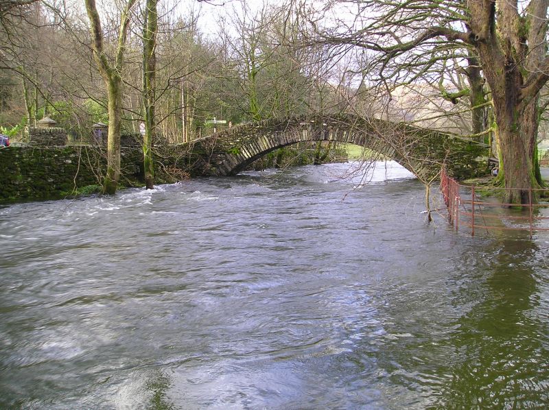
1.
1291A AMBLESIDE
Miller Bridge
NY 30 SE 10/5 12.1.67.
II
2.
See also Rydal and Loughrigg parish. Single segmental arch of radiating
slate slabs and stone rubble, humped, about 5 ft wide.
Listing NGR: NY3710004494
External links are from the relevant listing authority and, where applicable, Wikidata. Wikidata IDs may be related buildings as well as this specific building. If you want to add or update a link, you will need to do so by editing the Wikidata entry.


Other nearby listed buildings
