Approximate Location Map
Large Map »
Latitude: 52.7055 / 52°42'19"N
Longitude: -2.7358 / 2°44'8"W
OS Eastings: 350378
OS Northings: 312230
OS Grid: SJ503122
Mapcode National: GBR BK.2M4N
Mapcode Global: WH8BT.Y8D8
Plus Code: 9C4VP747+5M
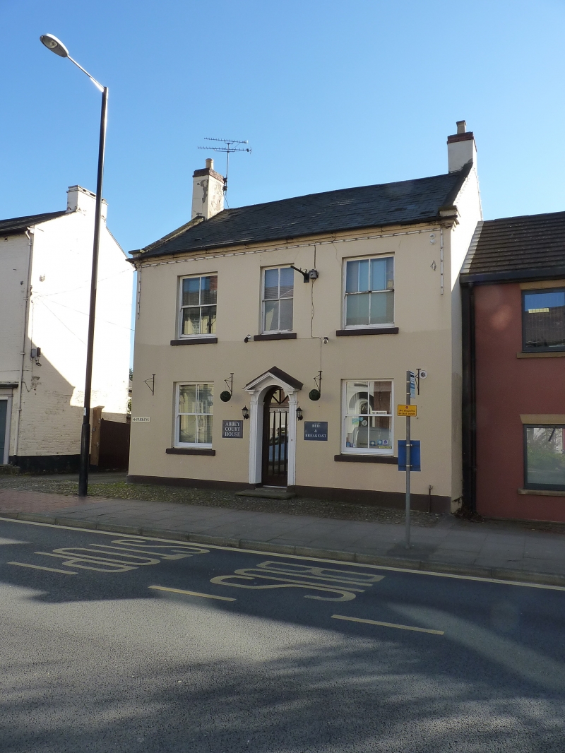
Entry Name: 134, Abbey Foregate
Listing Date: 10 January 1953
Grade: II
Source: Historic England
Source ID: 1246385
English Heritage Legacy ID: 454953
ID on this website: 101246385
Location: Cherry Orchard, Shropshire, SY2
County: Shropshire
Civil Parish: Shrewsbury
Built-Up Area: Shrewsbury
Traditional County: Shropshire
Lieutenancy Area (Ceremonial County): Shropshire
Church of England Parish: Shrewsbury Holy Cross
Church of England Diocese: Lichfield
Tagged with: Building
SHREWSBURY
SJ5012SW ABBEY FOREGATE
653-1/17/46 (South side)
10/01/53 No.134
GV II
House. Early C19. Render over brick with shallow pitched Welsh
slate roof. 2 storeys, 2-window range. Central door with
fanlight in pedimented case possibly renewed, and flanking
4-pane sash windows. Coped gables, and rebuilt gable end
stacks. Included for group value.
Listing NGR: SJ5037812230
External links are from the relevant listing authority and, where applicable, Wikidata. Wikidata IDs may be related buildings as well as this specific building. If you want to add or update a link, you will need to do so by editing the Wikidata entry.


Other nearby listed buildings
