Approximate Location Map
Large Map »
Latitude: 52.7054 / 52°42'19"N
Longitude: -2.7553 / 2°45'18"W
OS Eastings: 349065
OS Northings: 312236
OS Grid: SJ490122
Mapcode National: GBR BJ.2NC8
Mapcode Global: WH8BT.N85B
Plus Code: 9C4VP64V+5V
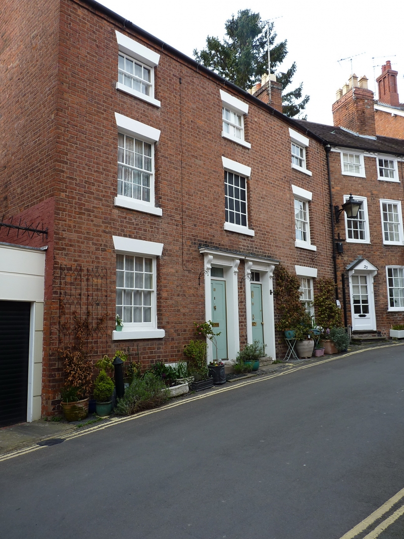
Entry Name: 18 and 19, Belmont
Listing Date: 19 September 1972
Grade: II
Source: Historic England
Source ID: 1246513
English Heritage Legacy ID: 455266
ID on this website: 101246513
Location: Shrewsbury, Shropshire, SY1
County: Shropshire
Civil Parish: Shrewsbury
Built-Up Area: Shrewsbury
Traditional County: Shropshire
Lieutenancy Area (Ceremonial County): Shropshire
Church of England Parish: Shrewsbury St Chad
Church of England Diocese: Lichfield
Tagged with: Building
SHREWSBURY
SJ4912SW BELMONT
653-1/15/120 (North West side)
19/09/72 Nos.18 AND 19
GV II
Pair of houses. Early C19. Brick with plain tiled roof.
3-storeyed, each a 3-window range with central doorways with
slight architraves and 4-panelled doors. Flanking windows are
16-pane sashes with flat-arched brick heads (blind over
doorways). Gable end stacks.
Listing NGR: SJ4906512236
External links are from the relevant listing authority and, where applicable, Wikidata. Wikidata IDs may be related buildings as well as this specific building. If you want to add or update a link, you will need to do so by editing the Wikidata entry.


Other nearby listed buildings
