Approximate Location Map
Large Map »
Latitude: 52.7074 / 52°42'26"N
Longitude: -2.7512 / 2°45'4"W
OS Eastings: 349339
OS Northings: 312453
OS Grid: SJ493124
Mapcode National: GBR BJ.2HCN
Mapcode Global: WH8BT.Q62T
Plus Code: 9C4VP64X+WG
Entry Name: 10, Dogpole
Listing Date: 19 September 1972
Grade: II
Source: Historic England
Source ID: 1247166
English Heritage Legacy ID: 456432
ID on this website: 101247166
Location: Shrewsbury, Shropshire, SY1
County: Shropshire
Civil Parish: Shrewsbury
Built-Up Area: Shrewsbury
Traditional County: Shropshire
Lieutenancy Area (Ceremonial County): Shropshire
Church of England Parish: Shrewsbury St Alkmund
Church of England Diocese: Lichfield
Tagged with: Building
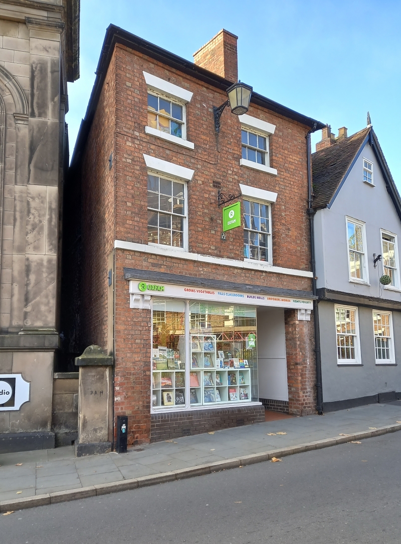
SHREWSBURY
SJ4912SW DOGPOLE
653-1/15/267 (East side)
19/09/72 No.10
GV II
Shop, possibly built as dwelling. Early C19. Brick with hipped
Welsh slate roof. 3 storeys, 2-window range. Inserted shop
front and 12-pane sash windows over (6-pane to second storey)
with continuous sill band at first floor, and flat-arched
stuccoed heads. Side wall stack.
Listing NGR: SJ4933912453
External links are from the relevant listing authority and, where applicable, Wikidata. Wikidata IDs may be related buildings as well as this specific building. If you want to add or update a link, you will need to do so by editing the Wikidata entry.


Other nearby listed buildings
