Approximate Location Map
Large Map »
Latitude: 51.2293 / 51°13'45"N
Longitude: 1.4021 / 1°24'7"E
OS Eastings: 637615
OS Northings: 153286
OS Grid: TR376532
Mapcode National: GBR X1R.TJ0
Mapcode Global: VHMDG.8C2H
Plus Code: 9F336CH2+PR
Entry Name: 1, College Road
Listing Date: 1 June 1949
Grade: II
Source: Historic England
Source ID: 1251220
English Heritage Legacy ID: 177029
ID on this website: 101251220
Location: Deal, Dover, Kent, CT14
County: Kent
District: Dover
Civil Parish: Deal
Built-Up Area: Deal
Traditional County: Kent
Lieutenancy Area (Ceremonial County): Kent
Tagged with: Building
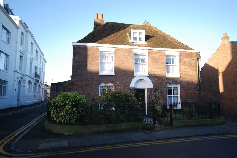
COLLEGE ROAD
1.
1035
(West Side )
No 1
TR 3753 SE 2/118 1.6.49.
II
2.
C18. 2 storeys and attic red brick. Tiled roof with wooden eaves cornice.
3 sashes with glazing bars missing. Round-headed recessed doorcase with 6 parallel
moulded door, the top 2 panels cut away and glazed.
Listing NGR: TR3761553286
External links are from the relevant listing authority and, where applicable, Wikidata. Wikidata IDs may be related buildings as well as this specific building. If you want to add or update a link, you will need to do so by editing the Wikidata entry.


Other nearby listed buildings
